Subject: Hawaii
Period: 1897 (published)
Publication: Sen. Doc. 178, 55th Congress, 2nd Session
Color: Black & White
Size:
22.3 x 15.4 inches
56.6 x 39.1 cm
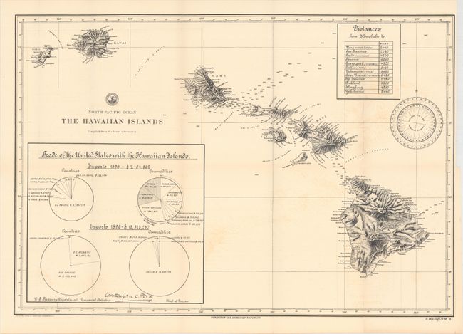
This detailed map of the Hawaiian Islands was included in a 184 page report issued by the Bureau of the American Republics. The map presents the rugged topography of the islands in a crisp, nearly three-dimensional perspective and locates numerous place names along the coast. On the Big Island, the lava flows of Mauna Loa from 1855, 1859, and 1880 are prominently depicted. In the oceans, numerous soundings are measured between the islands. Includes a distance chart at top and a trade table at lower left that reveals Hawaii exports over twice as many goods as it imports, with the vast majority of exports being sugar. The octavo, disbound report text is divided into nine chapters and provides an overview of its history, topography, climate, agriculture, commerce and more.
References:
Condition: B+
The folding map has some light offsetting and a binding trim at upper right. Disbound text is very good with pleasant light toning.