Subject: Florida
Period: 1849-1911 (dated)
Publication:
Color:
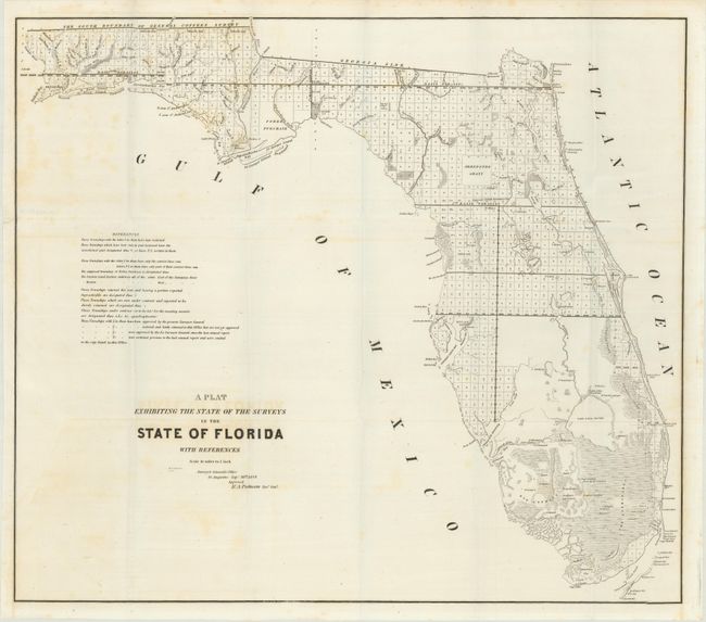
A. A Plat Exhibiting the State of the Surveys State of Florida with References, by U.S. State Surveys, dated 1849, black & white (25.3 x 22.3"). An interesting and detailed early lithographed map representing the progress of surveying in the state. The Everglades, Big Cypress, Arredondo Grant, Forbes Purchase and numerous forts are clearly shown. It extends to show Key Largo, here named as Cayo Largo. The map is filled with detailed notes related to surveys and townships. Issued from St. Augustine by R.A. Putnam, Surveyor General, dated September 30, 1849. Condition: Issued on a bright sheet with faint scattered foxing and a short edge tear at left that has been repaired with archival tape on verso. (B+)
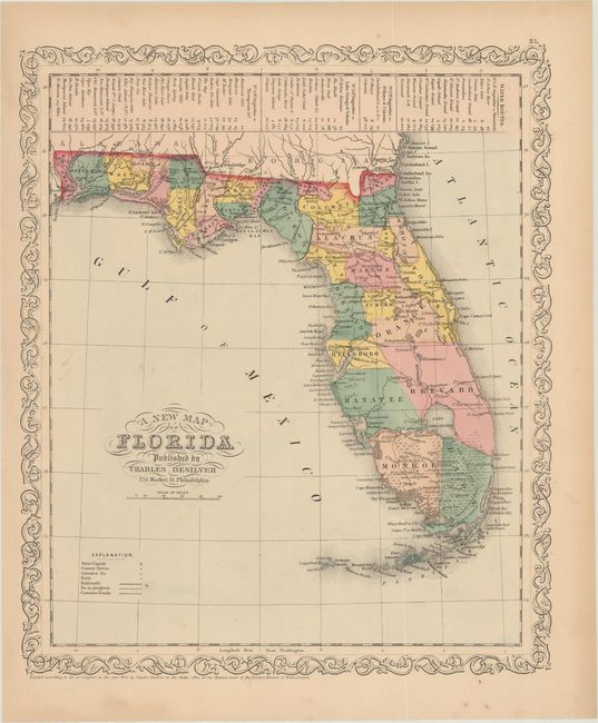
B. A New Map of Florida, by Charles Desilver, dated 1856, hand color (12.0 x 14.3"). This is a completely new map that was issued in the 1856 edition of Desilver's atlas. Based on Mitchell's earlier map of the state, Desilver's decorative border has been added and the three large insets in the Gulf of Mexico were removed. County configuration is current to 1854, with the newly established Volusia and pending Manatee depicted. Many forts are named, especially in the south, including Ft. Catlin, Taylor, Brooke, Lauderdale, Henry, Howell, Center, and Jupiter. A table at the top of the sheet shows the water routes from St. Augustine to various destinations around the state and southern Georgia. Condition: There are a few faint spots and light toning along sheet edges. (B+)
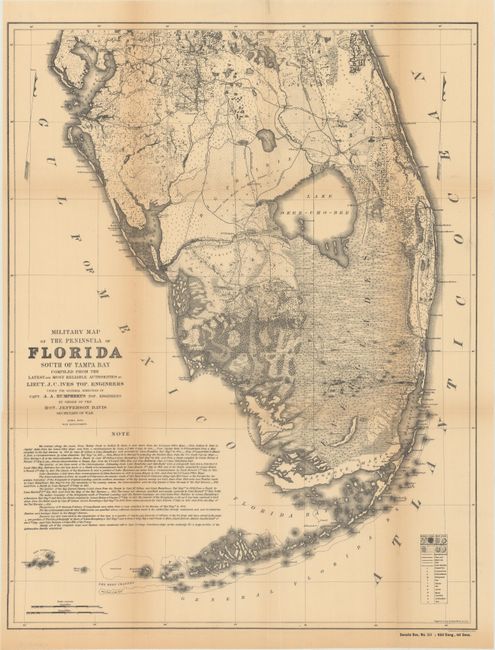
C. Military Map of the Peninsula of Florida South of Tampa Bay, by Lt. Joseph C. Ives, from Senate Doc. No. 89; 62d Congress, 1st Session, dated 1856 (published 1911), black & white (16.5 x 21.3"). This is an uncommon reprint of the 1856 map covering the southern portion of Florida. Issued under the direction of Jefferson Davis, this highly detailed map depicts swamps, marshes, sawgrass, scrubs and prairie land. In addition to the vegetation, the map shows towns and villages, forts, wagon roads and trails with an extensive note below the image. Condition: Issued folding with light toning along the folds with several small fold separations that have been repaired on verso with archival tape. (B)
References:
Condition:
See description above.