Subject: San Francisco, California
Period: 1884 (dated)
Publication:
Color: Printed Color
Size:
28.6 x 15.8 inches
72.6 x 40.1 cm
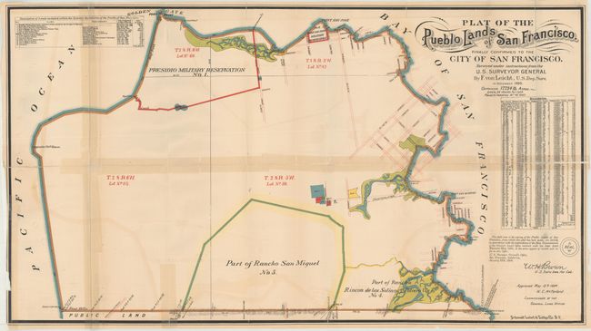
This map depicts the lands awarded to the city of San Francisco in a long standing dispute between the city and grantees who had been given land by the Mexican government prior to the Mexican-American War. The map is keyed to a legend that identifies the Presidio Military Reservation, Point San Jose Military Reservation, Part of Rancho San Miguel, Part of Rancho Rincon de las Salinas y Potrero Viejo, and several smaller land grants in the area of Mission Delores. A table at right shows the exact boundaries of the new city. Surveying work was completed by F. Von Leicht for the U.S. Surveyor General and lithography was completed by the firm Schmidt Label & Litho Co. in San Francisco. The map was issued in the San Francisco Municipal Reports for the 1886-87 fiscal year.
References:
Condition: C+
Issued folding with light offsetting. There are several short edge tears and a number of long fold separations that have been closed on both recto and verso with cello tape and other materials.