Subject: Eastern United States, Civil War
Period: 1883 (circa)
Publication:
Color: Printed Color
Size:
13 x 17.5 inches
33 x 44.5 cm
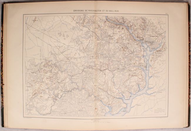
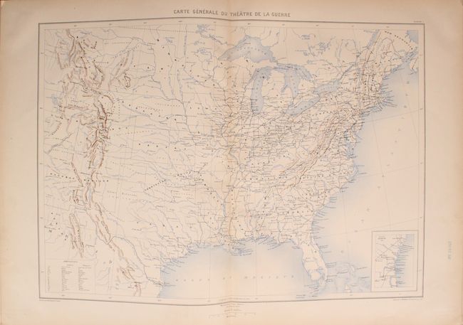
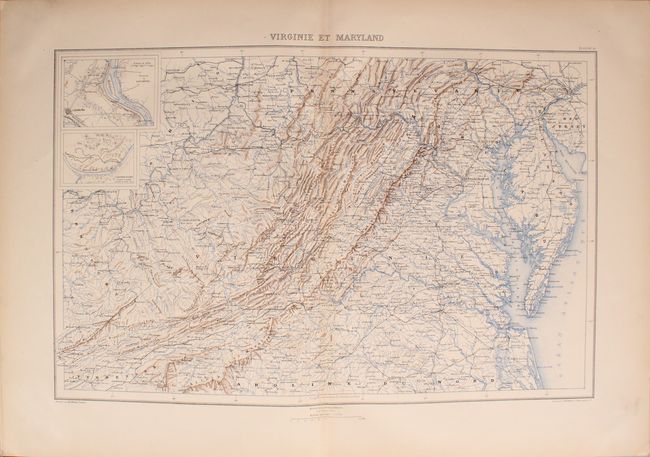
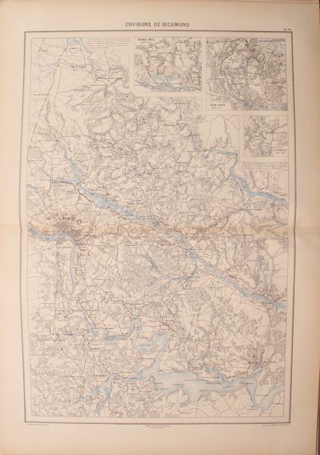
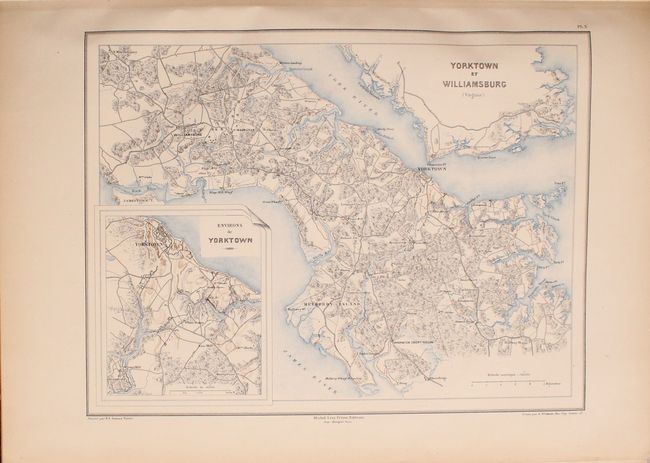
This collection of 19 maps (of 30 in a complete atlas) comes from the scarce French atlas to accompany Comte de Paris' Historie de la Guerre Civile en Amerique. These important, remarkably detailed maps should not be confused with the smaller maps issued with the American version of the History. Comte de Paris served the Union cause for a time under General McClellan which gave him access to the large, original U.S. Army maps. Of the 19 maps, 7 are double-page (approximately 14 x 20") including Environs de Washington et du Bull Run, Environs de Richmond, and Virginie et Maryland. Single-page maps of interest New Orleans, Charleston, and Yorktown. The maps were drawn by Dumas-Vorzet and engraved by Wuhrur. The complete atlas was printed in three phases in 1874, 1875, and 1883. This set represents the first two phases, but lacks the title pages. Folio, hardbound in quarter leather with tips over marbled boards.
References:
Condition: A
Condition code is for the maps, which are near fine with pleasant light toning along the sheet edges. The first map, as well as the preliminary pages, have embossed library stamps in the bottom blank margins. There is a library bookplate on the inside front cover with a "discarded" stamp on it. The covers and spine are moderately worn, the front hinge is starting at top, and there is a small chip in the spine also at top.