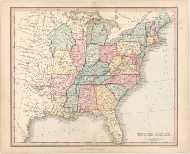
Subject: Eastern United States
Period: 1843 (circa)
Publication: A Modern Atlas; Forming a Complete Compendium of Geography...
Color: Hand Color
Size:
10.3 x 8.6 inches
26.2 x 21.8 cm
This handsome map of the United States extends to show the eastern part of Texas (labeled here as State of Texas despite the map pre-dating its statehood) and Western Territory. Published circa 1843, with all 26 of the states that were a part of the country at that time shown. Florida, Iowa, and Wisconsin are also outlined, although they had not attained statehood at this point. A large note running through northern Iowa indicates the presence of Sioux Indians. Published in London by William Tegg & Co.
References:
Condition: B+
There is light soiling, especially concentrated along the centerfold at top and bottom, and a short centerfold separation at bottom that has been closed on verso with archival materials.