Catalog Archive
Auction 165, Lot 90

"Etats-Unis de l'Amerique Divises en 13 Provinces avec leurs Limites, Suivant le Traite de Paix Fait le 20 Janvier 1783", Delamarche, Charles Francois

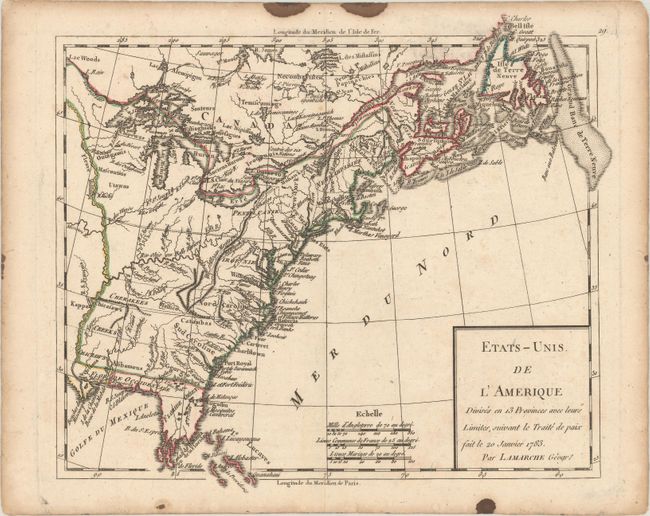
Subject: Eastern United States & Canada

Period: 1790 (circa)

Publication:

Color: Hand Color

Size:
9.3 x 8.1 inches
23.6 x 20.6 cm
Download High Resolution Image
(or just click on image to launch the Zoom viewer)

An attractive map of the young United States issued shortly after the Treaty of Paris. Virginia, North Carolina, South Carolina, and Georgia now extend to the Mississippi River, with numerous Indian tribes and several forts named and located in the interior. Florida is divided into East & West, with the southern tip of the peninsula represented by a few islands. Decorated by a simple block-style title cartouche and three distance scales.

References:

Condition: A

A dark impression with a few stains confined to the blank margins.

Estimate: $160 - $190

Sold for: $90

Closed on 11/15/2017

Archived