Catalog Archive
Auction 165, Lot 88

"Carte de l'Amerique Septentrionale, Depuis la Baye d'Hudson Jusqu'au Mississipi: pour Servir aux Essais Historiques et Politiques...",

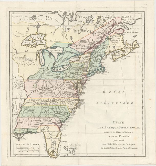
Subject: Colonial Eastern United States & Canada

Period: 1782 (circa)

Publication: Essais Historiques et Politiques sur les Anglo-Americans

Color: Hand Color

Size:
14.9 x 16.4 inches
37.8 x 41.7 cm
Download High Resolution Image
(or just click on image to launch the Zoom viewer)

This rare map was published in Michel Rene Hilliard d'Auberteuil's Essais Historiques et Politiques sur les Anglo-Americans. It covers the region from Nova Scotia to Florida and was issued just prior to the Treaty of Paris (1783). Virginia, North Carolina, South Carolina and Georgia all extend to the Mississippi River. Florida is divided between East & West, with the southern portion represented as an archipelago. The region around the Great Lakes region is "Pays Sauvages ci-devant sous la Protection du Roi D'Angleterre" (wild country formerly under the King's protection). Shows especially good detail of roads, trails, forts, and Indian villages to the west of the Appalachians.

References: Howes #H493.

Condition: A

Issued folding on watermarked paper with just a hint of soiling along the right fold.

Estimate: $400 - $500

Sold for: $300

Closed on 11/15/2017

Archived