Subject: Northern Canada
Period: 1823 (dated)
Publication: Narrative of a Journey to the Shores of the Polar Sea
Color: Black & White
Size:
18.9 x 31.8 inches
48 x 80.8 cm
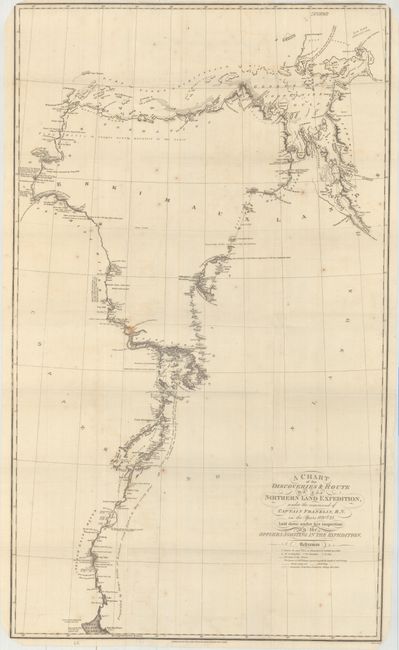
This detailed chart depicts Franklin's outgoing route from Great Slave Lake to Point Lake, and then up the Coppermine River to the Arctic Sea. His return trip would take him along the "gravelly beach" to the George IV Coronation Sound, and finally down the Hood River where his party wintered at Fort Enterprise. The map is filled with interesting notations including "Frequented by large herds of Reindeer from August to May every year" and "Destitute of wood except a few clumps of stunted pines and dwarf birch bushes." The map includes camp dates, stream directions, coordinates, portages, and more.
Sir John Franklin was a British explorer who joined the Navy in 1801 and fought in numerous battles, including the Battle of Trafalgar in 1805. In 1818 he was charged with leading an expedition over land from Hudson Bay to the mouth of the Coppermine River. On his first attempt he was forced to return home after only six months due to ice pack, but he set sail again in 1819 and was able to completed his journey in 1822. Unfortunately, the expedition was not well supplied, and Franklin lost half of his party due primarily to starvation. Franklin published his account in Narrative of a Journey to the Shores of the Polar Sea. Published by John Murray and engraved by J. Walker.
References: Sabin #25625.
Condition: B+
Issued folding with light scattered foxing and faint offsetting.