Subject: References
Period: 1970 (published)
Publication:
Color: Printed Color
Size:
13.4 x 21.7 inches
34 x 55.1 cm
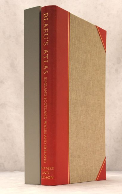
This gorgeous facsimile compiles all of Blaeu's maps of the British Isles, originally published in 1654 and 1662. It includes title pages from the 1654 and 1662 editions in beautiful full color and 115 maps, five of which are in color. Blaeu's maps of Europe and the world appear in addition to maps of England, Scotland, Wales, and Ireland and their counties. An introduction by R.V. Tooley provides an overview of the Blaeu family publishing company and the publication history of the maps reproduced here. This is #442 of 500 copies. Unpaginated. Hardbound with canvas covered boards and red leather spine and corners, with gilt title on the spine. It slides into a grey heavy cardboard slipcase.
References:
Condition: A
Contents and covers fine with light soiling and wear to the slipcase.