Catalog Archive
Auction 165, Lot 779

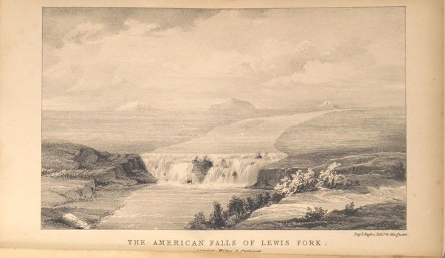
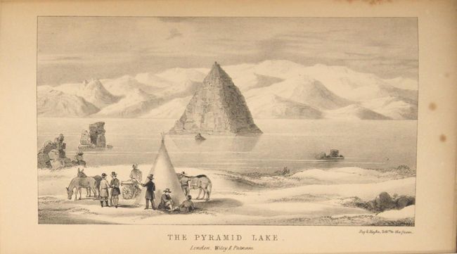
"Narrative of the Exploring Expedition to the Rocky Mountains, in the Year 1842, and to Oregon and North California, in the Years 1843-44 [with map] Map of the Western & Middle Portions of North America...", Fremont, John Charles

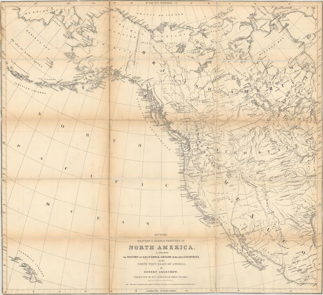
Subject: Exploration & Surveys, Western North America

Period: 1846 (published)

Publication:

Color: Black & White

Size:
9 x 6 inches
22.9 x 15.2 cm
Download High Resolution Image
(or just click on image to launch the Zoom viewer)

John C. Fremont is an important historical figure best remembered for his three explorations of the west in the 1840s. Fremont married Jessie Benton, daughter of Sen. Thomas Hart Benton in 1841. The Senator championed the idea of Manifest Destiny, pushing for national surveys of the West and arranging for his son-in-law to lead them.

From 1842 to 1846 Fremont led three explorations of the west with Kit Carson as guide and Charles Preuss as the topographer. His early route became know as the Oregon Trail and his explorations are credited with encouraging the huge overland migration to the west. He was the first American to see Lake Tahoe, and finally determined that the Great Basin is endorheic, or closed basin with no outlet to the sea.

Fremont went on to become a millionaire, a California senator, a governor to Arizona Territory, the man who is credited with saving Kit Carson's life, and much more, yet died penniless and in virtual obscurity. Some scholars regard Fremont as a hero of significant accomplishment, while others view him as a failure who repeatedly defeated his own best ideals. He remains an enigmatic figure in the history of the United States. Read more of his fascinating story here.

Fremont's Narrative of the Exploring Expedition to the Rocky Mountains [...] and to Oregon and North California describes one of the most important expeditions of the American West. Fremont and his traveling companion and topographer, George Carl Preuss, launched the expedition from the frontier settlement of Westport at the juncture of the Kansas and Missouri Rivers. There Fremont first met Kit Carson who signed on as guide to the expedition. Traveling across the Rocky Mountains at South Pass to the Columbia River in Oregon Territory, they then continued south along the Sierra Nevada nearly to the "Pueblo del los Angeles", northeast to Lake Utah and finally east to the Arkansas River. Fremont's report had a profound influence on emigration to the Far West as his westward route eventually became the Oregon Trail. Although Fremont's report was published in many editions, this is the only British edition, which follows the accounts of Fremont's first two expeditions, omitting the scientific portions of his reports. The book includes a map and four lithographic plates that do not appear in other editions of Fremont's report. The plates, by William Day and Louis Haghe, lithographers to the Queen, are: The American Falls of Lewis Fork, Hill of Columnar Basalt on the Columbia River, Devil's Gate, and The Pyramid Lake. This British edition also includes a preface on the Oregon Boundary Dispute.

The copper-engraved map, Map of the Western & Middle Portions of North America, to Illustrate the History of California, Oregon & the other Countries. On the North West Coast of America by Robert Greenhow (25.5 x 23.1"), shows the western part of North America. It extends to Acapulco in the south and north to show all of Alaska including the Bering Strait and a small portion of Russian Asia. The Sandwich Islands are at lower left. Canada is named British America with the region west and south of Hudson Bay called Hudson's Bay Company's Territories. The Red River Settlements are clearly shown south of Winnipeg Lake. Most of the United States is depicted, except for the southern and New England states, with no states or territories individually named. The Independent Republic of Texas, names S. Antonio de Bexar and Austin. Washington is shown as the capital; in 1836-37 five towns served as temporary capitals for the newly formed republic: Washington-on-the-Brazos, Harrisburg, Galveston, Velasco and Columbia. The Texas Declaration of Independence was enacted at Washington-on-the-Brazos on March 2, 1836, making it a logical choice for the first capital, a designation seen on few maps. The Great Basin is a large Sandy Plains Containing Salt Lakes & Swamps with no rivers or other features. According to Wheat, Greenhow included some early information from Fremont's explorations. Greenhow was a strong advocate of American expansion into the Northwest, so it is not surprising this map shows the Oregon Region extending well into Canada, a nod to the border dispute characterized by the famous "Fifty-four Forty or Fight" slogan. Drawn by George H. Ringgold and engraved by E.F. Woodward, both of Philadelphia. This map was also published in Greenhow's The History of Oregon and California and other Territories of the North-West… in 1845.

324 pp., map, 4 plates. Hardbound in original dark green blind-stamped cloth covers with new gilt-lettered spine.

References: Howes #F370; Sabin #25841; Wagner-Camp #115-6; Wheat (TMW) #481.

Condition: B

The map has been separated from the book, professionally dissected along the folds and mounted on linen, and folds into a linen pocket on the inside front cover of the book. The map has toning along the folds, a repaired 10" tear in the bottom right corner, and has been trimmed to the neatlines. The plates and text are lightly toned with an occasional spot of foxing. The binding is sound. The covers are lightly sunned and stained and the new spine is excellent.

Estimate: $800 - $950

Sold for: $400

Closed on 11/15/2017

Archived