Subject: Geography Books
Period: 1715 (dated)
Publication:
Color: Black & White
Size:
3.8 x 6.1 inches
9.7 x 15.5 cm
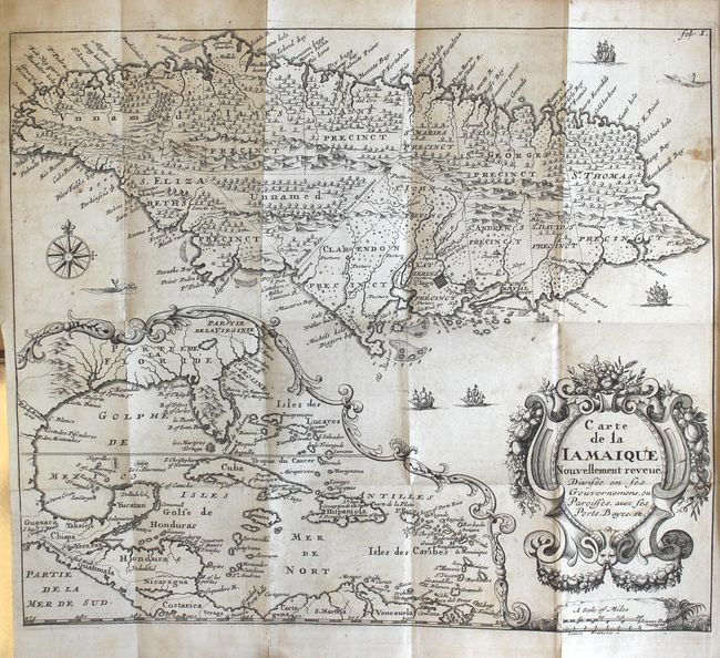
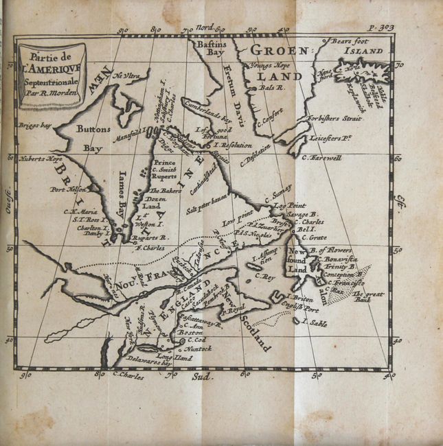
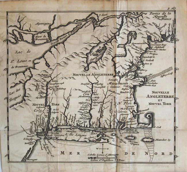
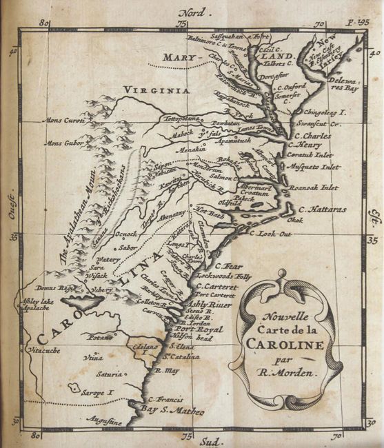
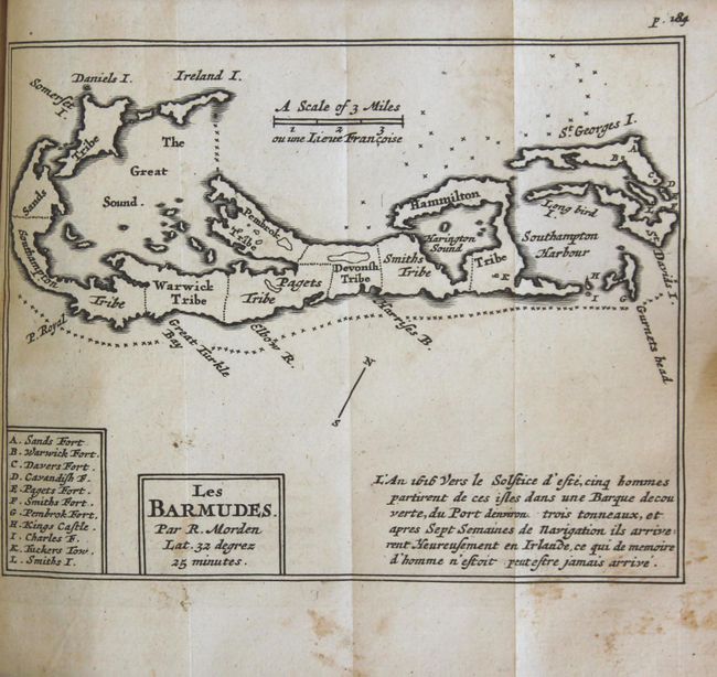
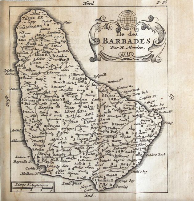
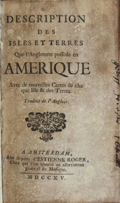
This is the second French edition of Richard Blome's guidebook to British colonial interests in North America, The Present State Of His Majesties Isles and Territories in America, first published in 1687. Howes calls Blome's work "a popular but unreliable guide which did much to attract emigration to these shores." The guidebook included chapters on a number of different islands in the Caribbean, as well as New York, New England, Pennsylvania, New Jersey, Virginia, Maryland, Carolina, and Newfoundland. New maps with French titles and nomenclature were engraved for the French edition, although they remained close copies of the original 7 maps from the English edition, which were based on the work of Robert Morden. This example includes 6 of the original 7 maps (missing the map of the Mid-Atlantic titled Nouvelle Carte de la Pensylvanie Maryland, Virginie et Nouvelle Iarsey).
A. Carte de la Iamaique Nouvellement Reveue Divisee en ses Gouvernemens, ou Paroisses, avec ses Ports, Bayes, etc. (11.4 x 9.9").
B. Partie de l'Amerique Septentrionale par R. Morden (4.8 x 4.3").
C. Nouvel Angleterre et Nouvel York (7 x 6.1").
D. Nouvelle Carte de la Caroline par R. Morden (4.4 x 5").
E. Les Barmudes. Par R. Morden (5.1 x 4").
F. Ile des Barbades par R. Morden (4.3 x 5").
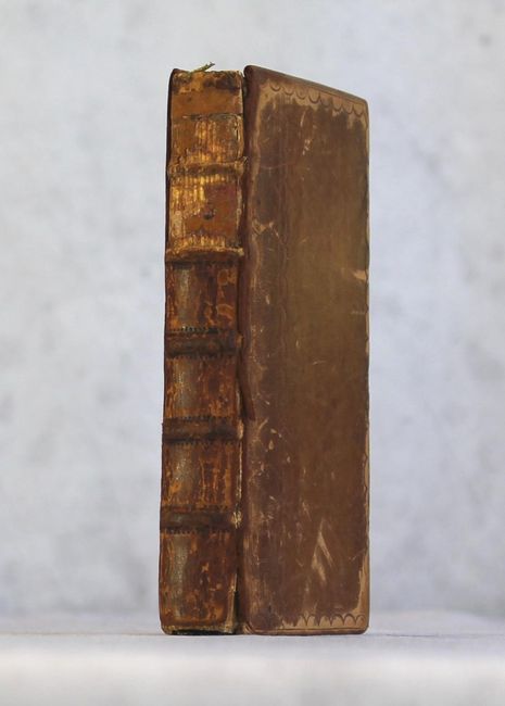
Published by Estienne Roger. 16mo., pp. [2], 331, [1], 6 folding maps. Hardbound in full embossed leather with raised bands on spine and marbled paper pastedowns.
References: Howes #B546; Sabin #5970.
Condition: B+
The maps have minor offsetting, light soiling, occasional foxing, and a couple of maps have short fold separations. The map of New England has light offsetting and several fold separations that have been closed on verso with archival tape. The text is clean and bright. The title page is moderately toned with several old manuscript notations. The spine is cracked and the upper third is missing. The covers are lightly worn and scuffed, with bumped corners.