Subject: Texas
Period: 1873 (published)
Publication:
Color: Hand Color
Size:
16.9 x 12.9 inches
42.9 x 32.8 cm
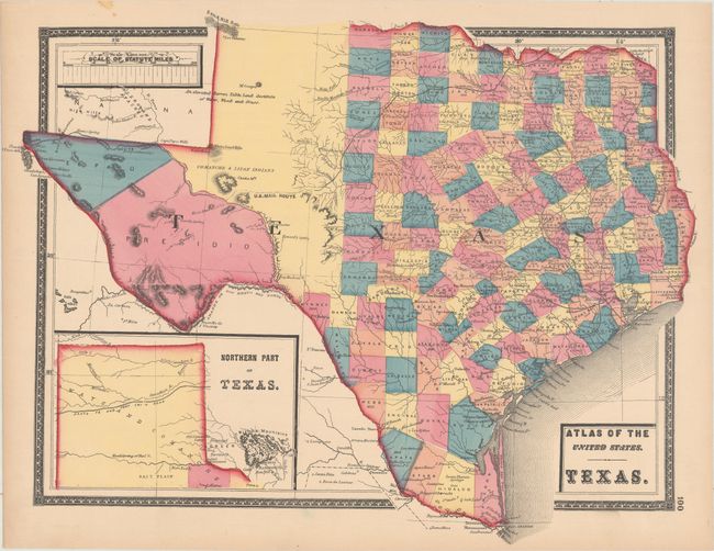
This scarce map appeared in a New Topographical Atlas of the State of Maryland and the District of Columbia...Together with Maps of the United States and Territories, published by Stedman, Brown & Lyon in Baltimore. The map presents good detail throughout the settled part of the state, with county configurations current to 1868 (prior to Wilson being renamed Cibilo in 1869). The western third is comprised of the large unsettled areas of Presidio, El Paso, and unnamed Bexar and Young territories. The evolving railroad network is well represented and the U.S. Mail Route is noted. Includes an inset entitled "Northern Part of Texas" at bottom left. Surrounded by a decorative border.
References: Phillips (Atlases) #1497; Rumsey #2339.
Condition: A
Vivid color on a clean sheet with a hint of toning along the sheet edges.