Catalog Archive
Auction 165, Lot 225

"Entwistle's Handy Map of Washington. And Vicinity Showing Public Buildings, Churches, Hotels, Places of Amusement, and Lines of Street Rail Roads",

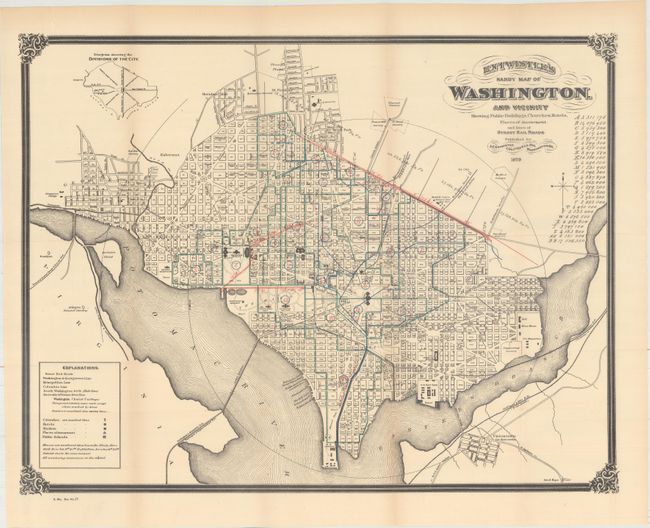
Subject: Washington, D.C.

Period: 1879 (dated)

Publication:

Color: Printed Color

Size:
21.8 x 16.8 inches
55.4 x 42.7 cm
Download High Resolution Image
(or just click on image to launch the Zoom viewer)

This is a great plan of the capital with all streets, railroads, bridges, buildings and monuments located and named. It shows part of Uniontown (or Anacostia), the Arlington National Cemetery, Georgetown College, and much more. The rail road system is shown with red, blue and green overprinting. On this example the colorist forgot to place rail colors in the legend. All surrounded by a bold border with decorative corner elements. Published by J.C. Entwistle in Washington.

References: Phillips (Maps) p. 1029.

Condition: B+

Issued folding with pleasant light toning and one tiny tear adjacent to the left border that has been closed on verso with archival tape.

Estimate: $200 - $250

Sold for: $100

Closed on 11/15/2017

Archived