Subject: Yosemite, California
Period: 1883-1931 (circa)
Publication:
Color: Printed Color
A nice set of Yosemite maps covering approximately 50 years:
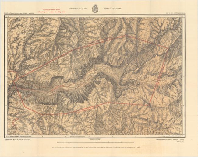
A. Topographical Map of the Yosemite Valley and Vicinity, by (Col.) J.N. Macomb, from U.S. Geographical Surveys West of the 100th Meridian, dated 1883 (21.3 x 14.6"). This fine map details the early development of the Yosemite valley after being designated a state park in 1864. The map is a product of Capt. G.M. Wheeler's Expeditions of 1878-79 with the U.S. Geographic Surveys West of the 100th Meridian, and depicts the state park boundaries and the toll roads leading to the park. Early camp facilities, trails, Indian settlements, and salient geographic features are also identified in considerable detail. The skillful rendering of the topography creates a remarkably strong graphic image of this picturesque valley. Mountain drawings by J.E. Weyss, with lettering by M. Franke, from the topographical plat by Lt. Macomb, Nov. 30, 1883. Condition: Clean and bright. (A)
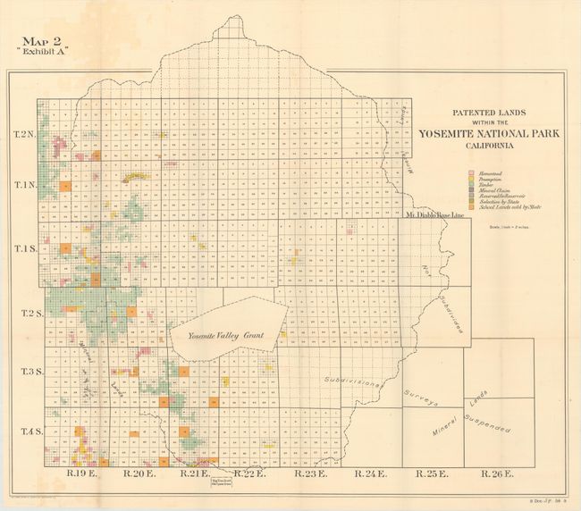
B. Patented Lands Within the Yosemite National Park California, by U.S. Government, circa 1903 (28.2 x 24.4"). Color-coded to show the various types of claims present within the existing boundaries of Yosemite including Homestead, Preemption, Timber, Mineral Claims, etc. On a scale of 2 miles per inch. Condition: Minor color offsetting at left, otherwise near fine. (B+)
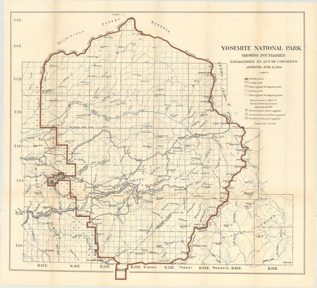
C. Yosemite National Park Showing Boundaries Established by Act of Congress Approved June 11, 1906, by Frank Bond, circa 1908 (27.3 x 24.8"). This colorful map illustrates the new boundaries of Yosemite National Park with the incorporation of the Yosemite Grant near the middle of the park and the Big Tree Grant at bottom. It contains considerable detail on a scale of 2 miles to the inch. A legend provides an explanation of symbols including existing and suggested trails and roads and patrol stations. Condition: Just a hint of toning along the folds. (B+)
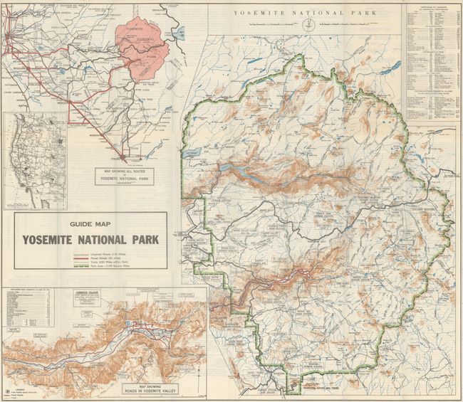
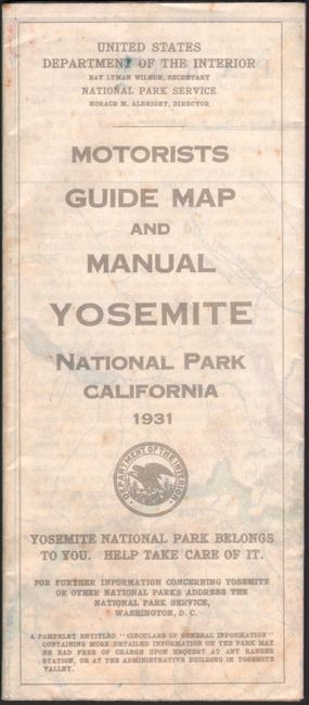
D. Motorists Guide Map and Manual - Yosemite National Park California, by U.S. Department of the Interior, dated 1931 (32.8 x 28.4"). A beautiful example of this unusually well done Park Service map. A color-coded key identifies the park boundaries, trails, paved roads, and unpaved roads. Includes insets "Map Showing all Routes to Yosemite National Park" and "Map Showing Roads in Yosemite Valley." The verso contains useful, park-related text. Condition: Clean, bright, and fine. (A+)
References:
Condition:
Issued folding. See description above.