Catalog Archive
Auction 165, Lot 157

One of the Earliest Obtainable Maps of Florida & the Southeast

"Florida et Apalche", Metellus, Natalius Sequanus

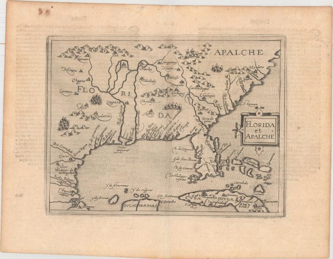
Subject: Colonial Southern United States

Period: 1598 (circa)

Publication: Geographische Und Historische Beschreibung Der Uberauss Grosser Landshafft America...

Color: Black & White

Size:
9.6 x 7.3 inches
24.4 x 18.5 cm
Download High Resolution Image
(or just click on image to launch the Zoom viewer)

This very rare map is a reduced version of Cornelis Wytfliet's map of 1597, and is one of only three 16th century printed maps of this region. Most of the information is derived from the Spanish explorations of Hernando de Soto, Cabeza de Vaca, and Moscoso. It is largely based on the Ortelius/Chaves map of 1584, but expanded to include parts of Cuba and the Bahamas and further north to show the territory of the legendary Apalche. The Florida peninsula is also presented in a more rectangular shape with a pronounced 'neck' at the top of the peninsula. The distorted Mississippi River is here called the Rio de S Spirito, the name given to it by the Spanish.

References: Burden #119; Cumming (SE) #20.

Condition: A

A nice, dark impression with a few spots of foxing in the top blank margin.

Estimate: $4,500 - $6,000

Sold for: $3,250

Closed on 11/15/2017

Archived