Subject: Southeast United States
Period: 1785 (circa)
Publication: Atlante Novissimo
Color: Hand Color
Size:
16.8 x 12.6 inches
42.7 x 32 cm
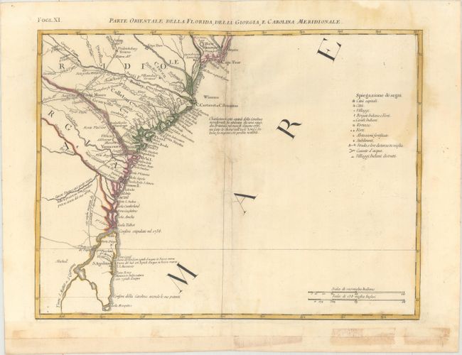
This detailed map covers the coastline from Wilmington and Cape Fear to St. Augustine and Cape Canaveral. The map depicts cities, town, Indian villages, forts and roads and is especially noteworthy for naming early counties in South Carolina. An Italian notation concerning the British attack on Charleston in 1776 and a key to the map appears in the Atlantic. At this time Florida was still British, having been acquired from Spain in 1763. The map is sheet XI from Zatta's Le Colonie Unite dell' America Settentrle, which is often referred to as the Italian edition of John Mitchell's map, on which it is based. Zatta's maps retain Mitchell's scale, but being smaller are more legible. Zatta also included updated legends (in Italian) with notations concerning the Revolutionary War. Each sheet stands on its own and has full borders.
References: Portinaro & Knirsch #153; Sellers and Van Ee #163; Shirley (BL Atlases) T.ZAT-1, Vol 4 #38.
Condition: B
Original color on paper with the watermark of three crescent moons with "Mezzana." There are stains along the centerfold at top and at right, along with professional repairs to a tear adjacent to the centerfold. The bottom margin had been cut off and reattached with non-archival tape, which has since been removed and the margin professionally reattached.