Catalog Archive
Auction 165, Lot 145

"Map of the Richmond and Louisville R.R. Connecting the Railroads of Virginia with the Railroads of Kentucky...", Colton, G.W. & C.B.

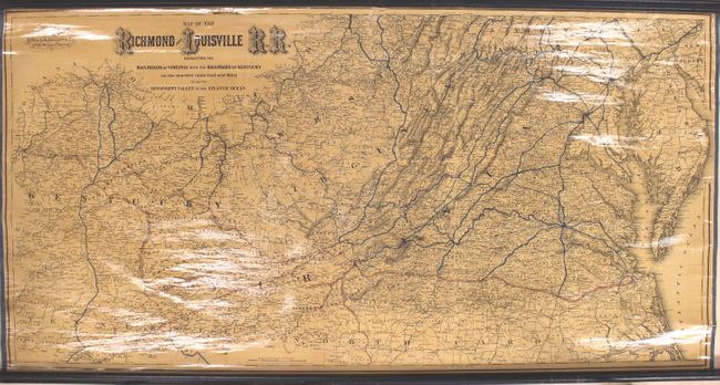
Subject: Virginia, West Virginia, Kentucky

Period: 1882 (dated)

Publication:

Color: Hand Color

Size:
50 x 25.5 inches
127 x 64.8 cm
Download High Resolution Image
(or just click on image to launch the Zoom viewer)

This large and very detailed wall map delineates the major railroad routes in Kentucky, West Virginia, and Virginia. The lines of the Richmond and Louisville Railroad are boldly shown in red overprinting stretching from Norfolk to Louisville, while other major lines are colored in blue. In southwest Virginia and eastern Kentucky, natural resources are identified and located including iron, coal, copper, salt, and timber. Original wooden rollers are present and attached.

References: Modelski #546; Phillips (Maps) p. 749.

Condition: B+

An overall nice, clean example with a few small chips and a 2" tear along the top neatline, resulting in some minor loss of image. Rollers are present and intact.

Estimate: $350 - $425

Sold for: $250

Closed on 11/15/2017

Archived