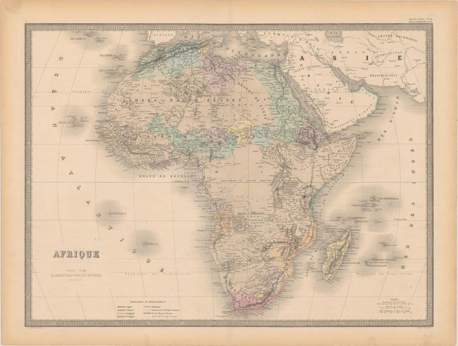
Subject: Africa
Period: 1876 (dated)
Publication: Atlas Universel
Color: Hand Color
Size:
24.6 x 18.4 inches
62.5 x 46.7 cm
This striking map of Africa shows political divisions, towns and cities, rivers, lakes, mountains, deserts, and more. A large section in the interior surrounding the equator is largely blank. Madagascar appears in fine detail, and the smaller island groups in the Atlantic and Indian oceans are located as well. A key at bottom left explains the color-coding system that delineates the holdings of the various colonial powers on the continent. Printed by Louis Antoine and engraved by Smith and Gerin.
References:
Condition: A
Original color with very minor offsetting. There is a centerfold separation in the bottom blank margin and toning along the sheet's edges.