Subject: China, Korea & Japan
Period: 1635 (circa)
Publication: Historia Mundi or Mercators Atlas…
Color: Hand Color
Size:
7.4 x 5.6 inches
18.8 x 14.2 cm
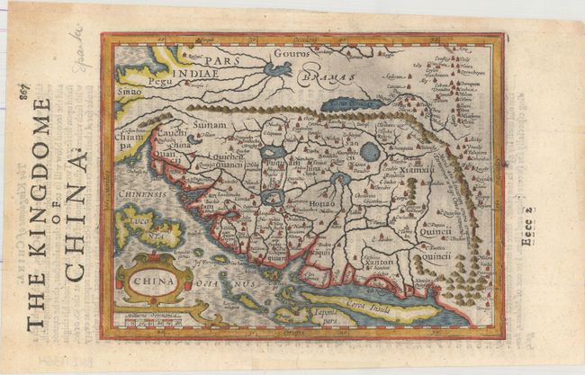
A charming map reduced from Jodocus Hondius' important map of the kingdom of China. Oriented with north to the right, it shows the eastern part of China (bounded in the west by the Great Wall) dominated by several large lakes and major rivers. Korea is a strangely shaped island, and the three main islands of Japan and the north part of the Philippines are included. English text on verso with some interesting comments on Chinese society. The Historia Mundi was published by Thomas Cotes, Michael Sparke and Samuel Cartwright of London in 1635, and reissued in 1637 and 1639. The maps were printed from the 1607 plates from the Atlas Minor.
References: Van der Krogt (Vol. III) #8410:351.
Condition: A
A dark impression on watermarked paper with light printer's ink residue, minor show-through of text on verso, and a few minute worm holes only visible when held to light.