Subject: Holy Land, Atlases
Period: 1600 (circa)
Publication:
Color: Black & White
Size:
10.1 x 14.6 inches
25.7 x 37.1 cm
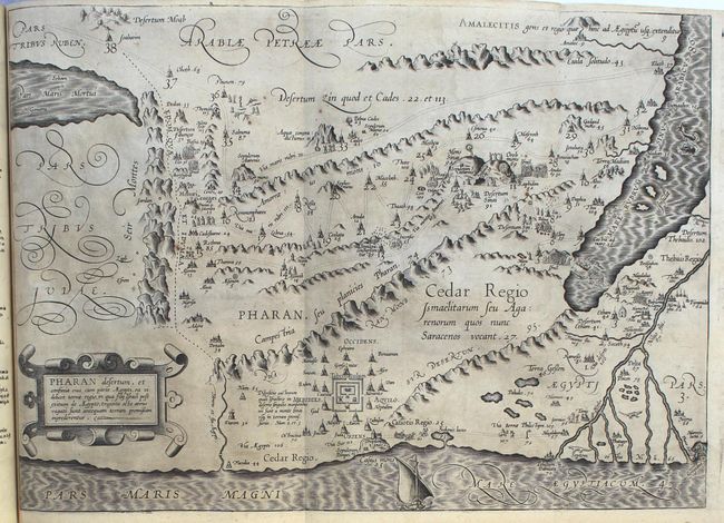
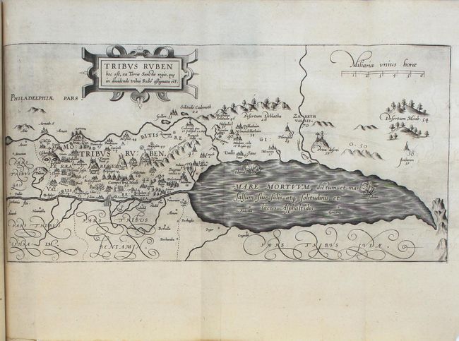
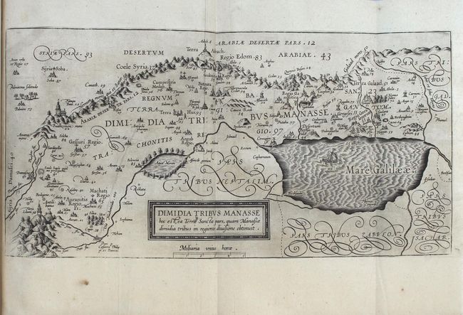
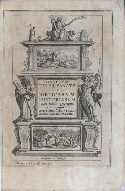
This atlas and history of the Holy Land is Adrichom's most important and famous work. Born in Delft, Christian Kruik van Adrichem, or Christianus Crucius Adrichomius, was a Catholic priest and theologian. Adrichom worked for thirty years on his three-part history of the Holy Land, and only succeeded in publishing the first part, Urbis Hierosolyma Depicta, during his lifetime. The remaining two parts were published posthumously by Georg Braun in 1590, with subsequent editions in 1593, 1600, 1613, 1628, and 1682. The Theatrum Terrae Sanctae contained 12 maps and plans: one of the Holy Land, nine of territories of the Tribes of Israel, one of the Exodus, and a town plan of Jerusalem. In this example, all of the maps are present, however only the western half of the Holy Land map is present.
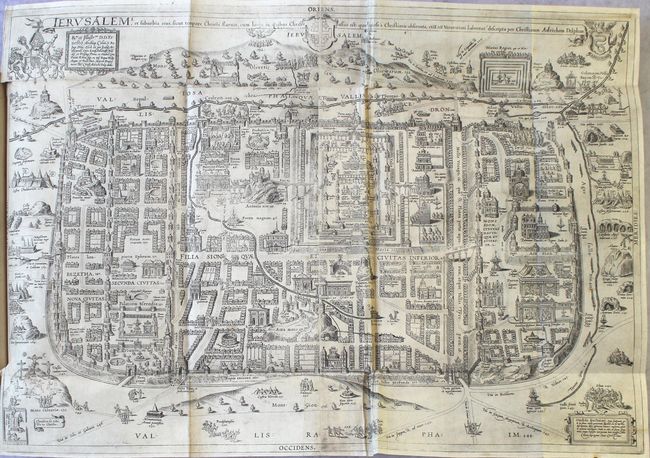
Kenneth Nebenzahl considers Adrichom's plan of Jerusalem "the most dramatic and important of the sixteenth century." Again, Adrichom used a myriad of sources to develop his plan, including Bernhard von Breitenbach's woodcut panorama of the city, Sebastian Munster's view, the texts of pilgrims Burchard of Mt. Sion and William Wey, and the Bible and Josephus. The plan is oriented to the north with the camps of the historic city's invaders just outside the city walls, and the ancient City of David and Mt. Sion in the south. There are over 250 key locations identified and numbered, which are more fully described in Adrichom's text. One of the most important contributions of the plan is Adrichom's identification of the locations of fourteen sites of the Stations of the Cross, which are still accepted today. Adrichom's plan of Jerusalem remained the definitive layout of the city until archaeological discoveries during the nineteenth century.
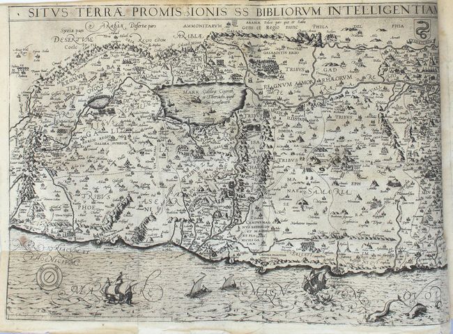
Adrichom's stunning map of the Holy Land, Situs Terrae Promissionis, was based on numerous sources, including Peter Laicksteen and Christian Sgrooten, Tilleman Stella, Jacob Ziegler, Sebastian Munster, Gerard Mercator, Buchard of Mt. Sion, and even Josephus, Jerome and Ptolemy. This map became immediately popular with leading cartographers such as Jan Jansson and Nicholas Visscher, who used it as the basis for their own maps of the Holy Land. North is oriented to the bottom left, and the map is divided into the tribes. The Kishon River erroneously connects the Sea of Galilee with the Mediterranean. The map is finely engraved with minute detail and depicts numerous biblical scenes including the Jonah and the Whale and several battle scenes. Sailing ships, sea monsters, Adrichom's coat of arms, and a compass rose complete the composition.
Small folio, 286 pp., 12 maps (with half a map missing), title page, preface and index. Hardbound in quarter leather with marbled paper boards.
References: Nebenzahl (Holy Land), pp. 90-91 & 94-97; Laor #7-18 & 934.
Condition: B+
The maps are generally dark impressions with very light toning and a few spots. Several maps have short binding tears and minor misfolds. The map of the Tribe of Aser has a small hole, and the plan of Jerusalem has a few short fold separations. The text is lightly toned with occasional foxing, although the title page and first page of text are moderately toned. The spine is detached, but has been kept inside the book and could be easily reattached. The hinges are starting and the covers have large abrasions in the corners.