Catalog Archive
Auction 164, Lot 619

Uncommon Chart of Central Mediterranean Between Sicily and Tunisia

"Nieuwe Paskaart van de Zee Kusten van 't Eylandt Sicilia en de Tegen Over Gelegende Kusten van Barbaria...", Keulen, Johannes van

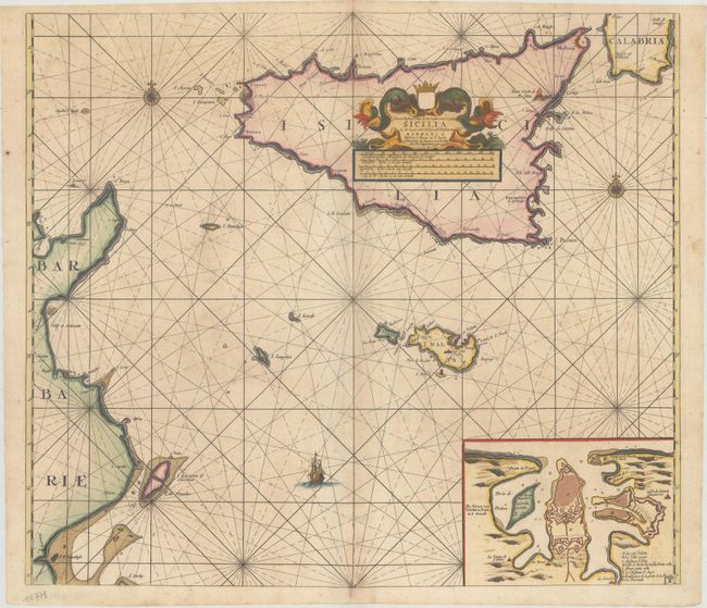
Subject: Central Mediterranean, Sicily

Period: 1697 (circa)

Publication:

Color: Hand Color

Size:
22.7 x 19.9 inches
57.7 x 50.5 cm
Download High Resolution Image
(or just click on image to launch the Zoom viewer)

This handsome chart shows the relationship between Sicily, mainland Italy, and the eastern coastline of Tunisia. A large inset depicts the city and bay surrounding Valletta on the island of Malta, with a lettered key identifying important locations. Geographical detail is confined to the coastlines. The large title cartouche fills the interior of Sicily and features sea monsters, a distance scale, and a blank coat of arms cartouche.

References:

Condition: B+

A nice example with one small hole south of Sicily, minor soiling, a hint of toning along the centerfold, and an archivally repaired centerfold separation that enters 2.5" into map at bottom.

Estimate: $2,000 - $2,300

Unsold

Closed on 9/13/2017

Archived