Catalog Archive
Auction 164, Lot 488

"Nouvelle Carte de l'Irlande, ou on Remarque l'Etat Present de Cette Isle, l'Ordre du Gouvernement Ecclesiastique et Politique...", Chatelain, Henry Abraham
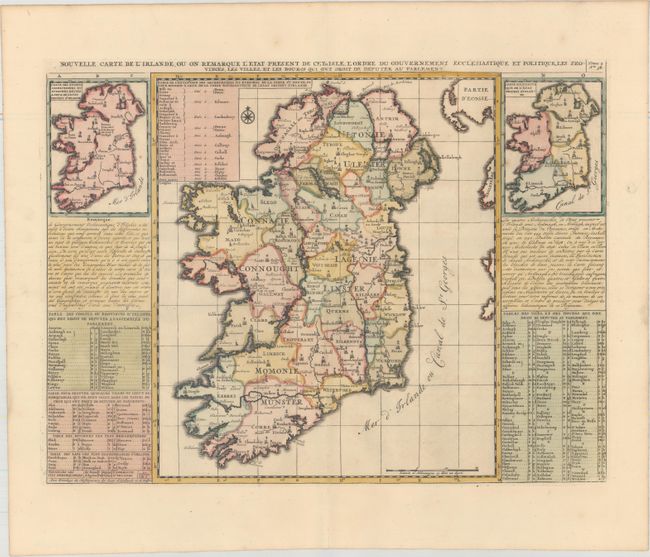
Subject: Ireland

Period: 1708 (published)

Publication: Atlas Historique…

Color: Hand Color

Size:
18 x 13.6 inches
45.7 x 34.5 cm
Download High Resolution Image
(or just click on image to launch the Zoom viewer)

Handsome map of Ireland flanked with two smaller maps of the country showing changes from the ancient system of ecclesiastic divisions and how it was divided at the time of this map's creation. Detailed tables and panels of text surround the map with extensive information on the ancient towns, cities, lakes, rivers, and the governance of Ireland.

References:

Condition: A+

A crisp impression on paper with an "I C H" watermark and a hint of toning along the edges of the sheet.

Estimate: $160 - $190

Sold for: $120

Closed on 9/13/2017

Archived