Subject: Peru
Period: 1633 (published)
Publication: Gerardi Mercatoris et I. Hondii - Atlas...
Color: Hand Color
Size:
19.3 x 14.9 inches
49 x 37.8 cm
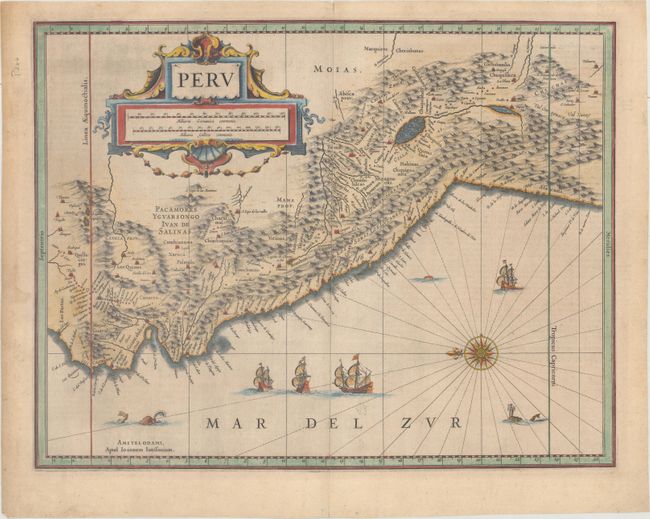
A large compass rose orients north to the left on this map of the Empire of Peru. It covers the Pacific coast of South America from Ecuador as far south as the Atacama Desert in the northern reaches of Chile. It includes the Potosi silver mines, Titicaca, Cusco, Quito and numerous other towns and villages. The large cartouche incorporates both the title and the distance scales and is decorated with sea shells. The sheet is further decorated with four Spanish galleons and three sea monsters. This map is one of the many similar maps that were produced by Jansson and Blaeu. German text on verso.
References:
Condition: A
A dark impression on paper with a large "A" watermark, minor printer's ink residue, and a few tiny worm holes only visible when held to light. There is a light damp stain in the left blank margin, short centerfold separations at top and bottom, and remnants of hinge tape on verso.