Subject: Yellowstone, Wyoming
Period: 1878 (dated)
Publication:
Color: Black & White
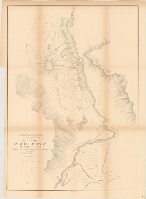
A. Map of the Egeria Springs Firehole River between the Upper and Lower Geyser Basins (17.0 x 23.9"). This map depicts the Midway Geyser Basin in Yellowstone National Park, which contains two of the largest hot springs in the world. The "Grand Prismatic Spring" is shown at the center of a web of connected creeks emptying into the Firehouse River. To the south, near the bend in the river, is an unnamed "Geyser" (Excelsior Geyser), which at the time could erupt up to 300 feet high and has since become a hot spring. Rudyard Kipling, who visited Yellowstone in 1889, immortalized this basin by referring to it as "Hell's Half Acre." Plotted by Henry Gannett under the direction of F.V. Hayden, Geologist in Charge.
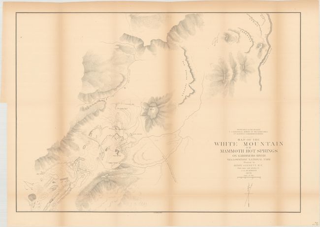
B. Map of the White Mountain or Mammoth Hot Springs on Gardiners River Yellowstone National Park (23.9 x 17.0"). Presents good detail of the Mammoth Hot Springs region of Yellowstone National Park. Locates the Main Springs, Sulphur Spring, Cleopatra Spring, and bath houses. Shows a planned road just to the west of Lookout Hill and the Gardiner River is depicted farther to the east.
References:
Condition: B
Light toning primarily along the folds and a few tiny splits at fold intersections. The Egeria Springs map has one fold separation that just enters the map image that has been closed on verso with archival tape.