Subject: Mississippi
Period: 1842 (dated)
Publication: Morse's North American Atlas...
Color: Printed Color
Size:
11 x 14.4 inches
27.9 x 36.6 cm
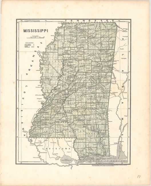
This map was printed using the revolutionary cerographic process, a milestone in cartographic printing techniques. This early printed color technique was an important change in the way maps were produced and the only truly American cartographic publishing innovation.
This early cerographic map was published in Morse'e North American Atlas. It is delineated by county and township and shows good detail of towns and settlements, canals, wagon roads, and railroads. County configurations are current to 1841, with the addition of Harrison from Hancock County in the southernmost part of the state.
References:
Condition: B+
Light scattered foxing.