Subject: Minnesota
Period: 1866-72 (circa)
Publication:
Color: Hand Color
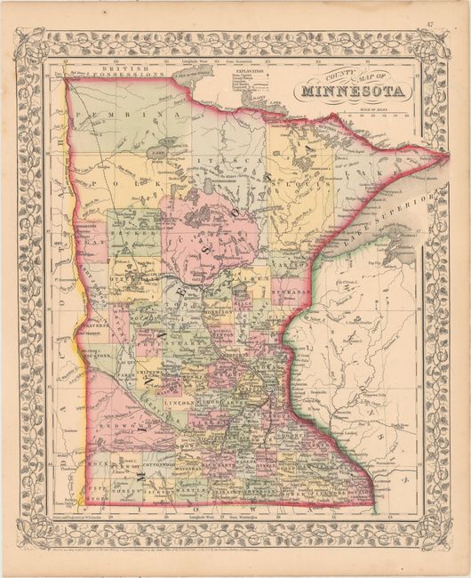
A. County Map of Minnesota, by Samuel Augustus Mitchell, dated 1866 (12.7 x 13.9"). This detailed map locates counties, towns and cities, roads, Indian agencies, rivers, lakes, and railroads both proposed and operational. County configuration is current to 1865, but the locations of Rock and Pipestone counties in the southwest corner of the state are inexplicably reversed. There are brief notes on the rivers and geography dispersed throughout, such as Dividing Ridge between the Water's flowing into the Hudson's Bay and Highest point reached by Steamboat in 1858. The map is surrounded by a lovely floral border. Drawn and engraved by W.H. Gamble. Condition: A few minor spots of foxing, mostly in the blank margins. (A)
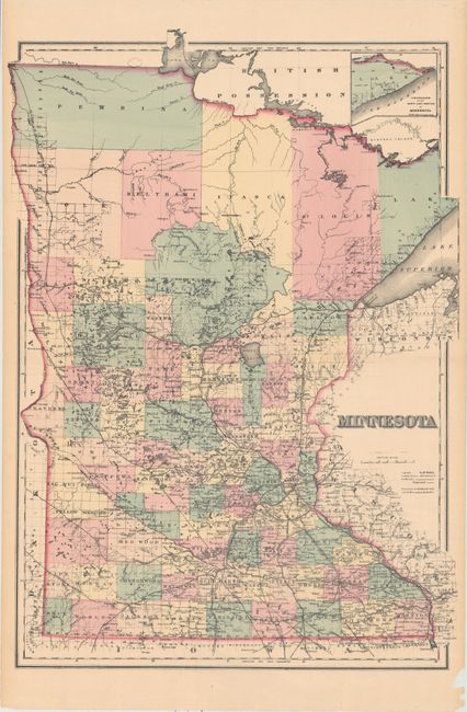
B. Minnesota, by O.W. Gray and Son, circa 1872 (16.9 x 23.7"). This double-page map of the state features excellent detail throughout. County development is current to 1872, with Aikin County now called Aitkin and no sign of Lincoln County. There is an extensive network of railroads in the southern half. The northern counties have little to no settlement. An inset at top right extends to show the northeast portion of Minnesota. Condition: There is pleasant light toning with numerous edge tears, a few of which enter the image, that have been partially closed on verso with archival tape. (B)
References:
Condition:
See description above.