Subject: Eastern Florida
Period: 1850-53 (dated)
Publication:
Color: Hand Color
The Office of Coast Survey is the oldest U.S. scientific organization, dating from 1807 when Congress directed that a "survey of the coast" be carried out. By 1836, it was called the U.S. Coast Survey and in 1878, the name was changed to the U.S. Coast and Geodetic Survey. Today the Office of Coast Survey is a division of the National Oceanic and Atmospheric Administration NOAA.
The survey teams, composed of civilians as well as Army and Naval officers, charted the nation's waterways and produced a wide array of reports, survey charts, hydrographic studies of tides and currents, astronomical studies and observations, and coastal pilots. These charts are an important record of the changing nature of the nation's coastlines. In additional to coastal charts, the U.S. Coast and Geodetic Survey produced land sketches, Civil War battle maps, and the early aeronautical charts.
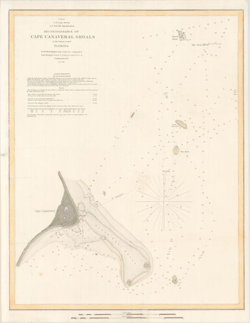
A. Reconnoissance of Cape Canaveral Shoals on the Eastern Coast of Florida, dated 1850 (15.4 x 19.5"). This attractive chart extends from Cape Canaveral to the Hetzel and Ohio shoals and presents a wealth of navigational information including soundings, soil types, anchorages, and shoals. Includes sailing directions and additional notes. Produced under the direction of A.D. Bache. Condition: Issued folding, now flattened and backed with tissue to reinforce and repair numerous small fold separations. The sheet has been remargined at left.
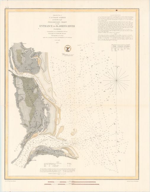
B. Preliminary Chart of the Entrance to St. John's River Florida, dated 1853 (14.3 x 18.1"). This detailed chart depicts the mouth of St. John's River near Jacksonville. It features plenty of navigational information including soundings, bottom types, breakers, buoys, and sailing directions. There is fine topographical detail along the coasts, and several small islands are named, among them Fort George, Talbot, and Batten islands. Produced under the direction of A.D. Bache. Drawn by Arthur Balbach and engraved by E. Yeager and H.M. Knight. Condition: Issued folding, now flattened and backed with tissue to reinforce and repair a 1" binding tear at left.
References:
Condition: B+
See description above.