Subject: World & Continents
Period: 1705-17 (dated)
Publication: L'Atlas Curieux
Color: Hand Color
Size:
13.5 x 9.1 inches
34.3 x 23.1 cm
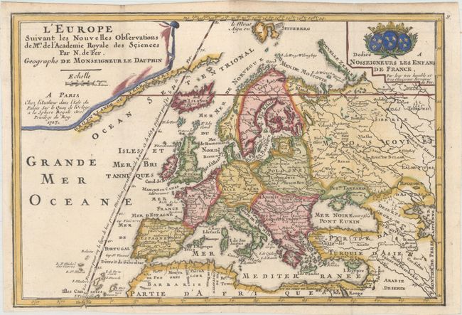
This appealing matched set of maps reflects several geographical myths that were prevalent at the beginning of the eighteenth century. Each is richly embellished with title, scale and dedication cartouches.
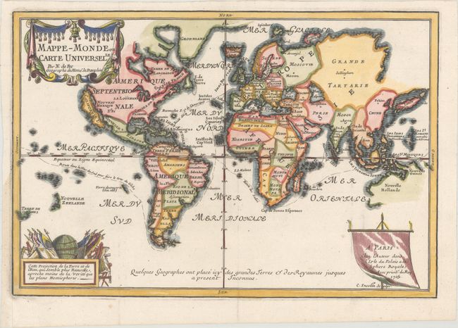
1) Mappe-Monde ou Carte Universelle is presented on Mercator's projection with a prominent island of California. Only part of the coastline of Australia appears, as well as parts of Tasmania and New Zealand. Major sea routes are shown traversing the world.
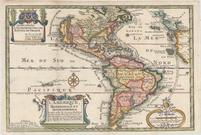
2) L'Amerique, Meridionale et Septentrionale also features an insular California with an indented northern coast and the Agubela de Cato peninsula just to the north of the island. One of the prominent features in northern Mexico is Les Mine de S. Iean et de Ste. Barbe, the legendary Santa Barbara mines of the Chihuahua-Durango region. The partial coast of New Zealand appears next to the title cartouche.
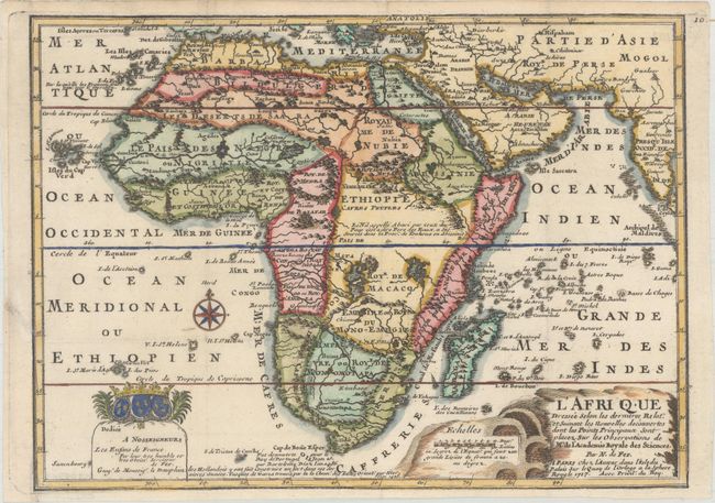
3) L'Afrique shows the correct source of the Nile, but retains the two large twin lakes south of the Equator. Unusual islands appear in the Atlantic and Indian Oceans including a mythical second island of St. Helena. Monomotapa is shown in the south, and the southwest coastline is distorted. There is an incorrect placement and shape of the Cape of Good Hope.
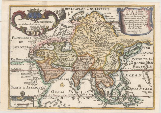
4) L'Asie depicts a continuous land bridge extending from northern Korea and eastern Siberia across nearly to the American Northwest. A note acknowledges Portuguese sources for this new portrayal of the region. Hokkaido (Ieso) appears as a small circular island north of Japan. The northern coastline of Asia is based on Witsen's explorations including Cap Tabin and Cap de Glace. The interior is filled with details, including what appears to be a road from Moscow to Peking, and the Great Wall of China. The Caspian Sea is presented in an unusual shape. The coastline of a portion of New Guinea is incorrectly named as Nouvelle Zeelande.
5) LL'Europeextends north to include Spitzbergen and shows the prime meridian through the Isle de Fer. A partial coastline of Greenland appears adjacent to the title cartouche.
References: Betz #170.3; McLaughlin #135; Yeo #82.
Condition: A
Fine impressions on watermarked paper, issued folding. The margins have been professionally extended where they were trimmed by the binder with repairs to a couple of tiny binding tears.