Catalog Archive
Auction 164, Lot 187

"[Lot of 2] (United States of North America) Die Staaten von N. & S. Carolina Georgia & Florida [and] Die Staaten von Arkansas, Mississippi, Louisiana & Alabama", Hildburghausen Biblio Institut

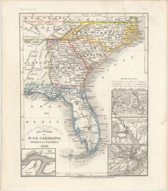
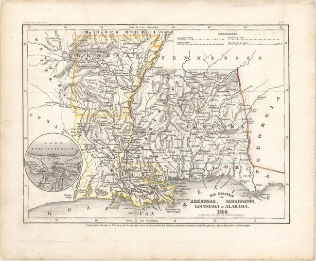
Subject: Southern United States

Period: 1850 (dated)

Publication: Meyer's Zeitung's-Atlas

Color: Hand Color

Size:
See Description
Download High Resolution Image
(or just click on image to launch the Zoom viewer)

A. (United States of North America) Die Staaten von N. & S. Carolina Georgia & Florida, (7.8 x 10.0"). A very detailed map of the southeastern United States showing roads, towns, railroads, and rivers. There are four insets: Hafen von St. Augustine, which shows Anastasia Island, St. Augustine, and the location of Fort St. Marks; Charleston; Newberne; and the gold region of North Carolina.

B. Die Staaten von Arkansas, Mississippi, Louisiana & Alabama, (10.5 x 7.9"). This attractive, steel engraved map has very nice detail of the major cities, roads, and railways of the region. Little Rock is also named Arkopolis. There is a circular inset that shows part of Lake Pontchartrain and New Orleans with the Mississippi River flowing between Red Church and Woodville.

References:

Condition: A

There is minor soiling mostly confined to the blank margins.

Estimate: $140 - $180

Sold for: $100

Closed on 9/13/2017

Archived