Subject: United States
Period: 1833 (published)
Publication: A Moral and Political Sketch of the United States of North America
Color: Hand Color
Size:
14.3 x 11.6 inches
36.3 x 29.5 cm
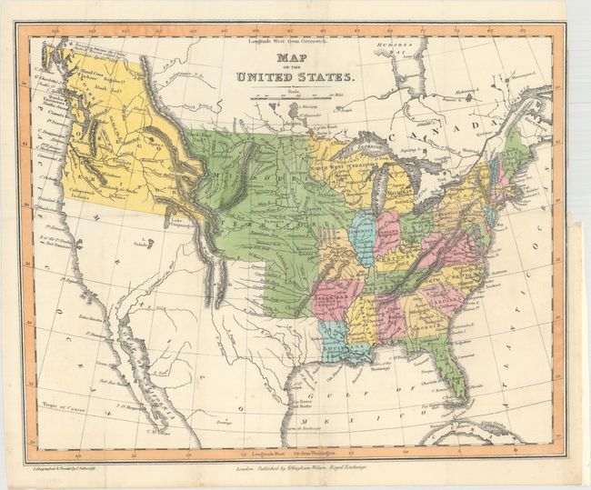
This uncommon map was published in Achille Murat's A Moral and Political Sketch of the United States of North America. It shows the United States following the Missouri Compromise with both the state and territory of Missouri depicted. It shows the United States in control of present-day British Columbia with the "Boundary between the United States & Russia settled by Convention April 5th...1824." The boundary with Mexico is per the Treaty of 1819 and includes Texas (unnamed). Missouri Territory encompasses the entire Great Plains from Texas to Canada and from the Mississippi River to the Rocky Mountains. Other territories include Michigan, North West and Arkansas, the capital of which is Little Rock or Arkopolis. The map presents a particularly good view of the rivers and Indian nations in the West. Lithographed and printed by J. Netherclift, and published by Effingham Wilson in London.
References:
Condition: A
A clean, bright example issued on "J Whatman 1832" paper with a binding trim at top right.