Subject: Geography Books
Period: 1809 (published)
Publication:
Color: Black & White
Size:
4.4 x 7 inches
11.2 x 17.8 cm
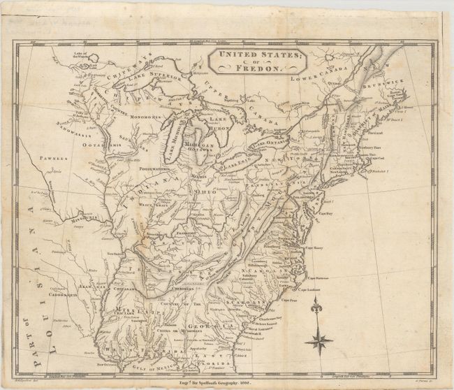
This school geography book by Horatio G. Spafford includes a map of the eastern United States suggesting a new name for the young Republic: Fredon. This is the first map to use the name Fredon, which Spafford suggests as a more appropriate name for the nation. He writes: "And, convinced as I am of its utility, I shall occasionally make use of FREDON, as a proper general generic term for the United States of America; and of the derivatives of FREDON, as occasion shall require. Thus Fredon, or Fredonia will form a national name for our country; the people thereof will occasionally be styled Fredes, or Fredonians, and our adjective epithet will be Fredish, or Fredonian. To every writer the convenience and even elegance of this arrangement must be particularly obvious." The name Fredon was originally coined by Dr. Samuel Mitchill in his Medical Repository in 1803. The map, titled United States; or Fredon (9.8 x 7.8"), extends just past the Mississippi River into Louisiana Territory and identifies the locations of numerous Indian tribes. Drawn by Spafford and engraved by G. Fairman.
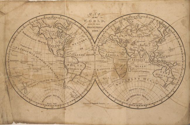
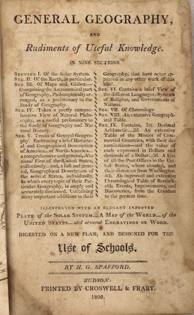
Also included in General Geography... is a double-hemisphere map of the world that claims to show "the latest discoveries," although Tasmania is still shown connected to Australia. The plate depicting the solar system is lacking in this copy of General Geography... 381 pp., 12mo., hardbound in original full leather with title label and gilt titling on spine.
References: Sabin #88847.
Condition:
The map of Fredon is in very good condition (B+) and has been removed from the text and professionally conserved. A binding trim at top right has been replaced with period-correct paper, and there is light toning along several folds and some minute worm holes. The world map (B) has some toning, offsetting, soiling, and a professionally repaired tear that extends from the left edge of the sheet to Africa, with some stains caused by old cello tape that has been professionally removed. A chip in the left blank margin has been replaced with old paper. The text is toned with light foxing throughout and damp stains mostly in the latter half. The front hinge has been professionally reinforced, and the back hinge is nearly perished. The back cover is warped from damp staining and the spine has been professionally reinforced.