Subject: New York
Period: 1833 (dated)
Publication:
Color: Hand Color
Size:
22.5 x 18.6 inches
57.2 x 47.2 cm
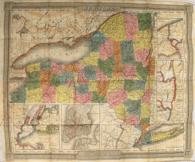
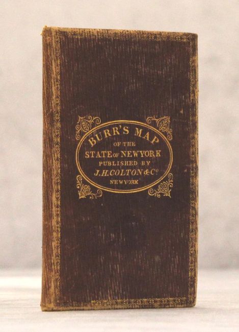
This rare pocket map was issued only a few years after Burr's famous Atlas of the State of New York and prior to his New Universal Atlas. It was published by the J.H. Colton firm and represents that company's first map of New York. County configurations are represented in full color with good detail of towns, roads, railroads, canals and rivers. The recently completed Erie Canal is shown connecting Albany to Buffalo. Inset maps surround the main main image, including two of New York City, Utica, Niagara River, and Albany to Lake Champlain. Drawn by David Burr and engraved by S. Stiles. Surrounded by a decorative border and folds into maroon boards with gilt title on front cover.
References:
Condition: B
Original color with light toning, offsetting, and scattered foxing. Covers are moderately worn.