Subject: New Hampshire
Period: 1816 (circa)
Publication: A New and Elegant General Atlas...
Color: Hand Color
Size:
8.3 x 10.6 inches
21.1 x 26.9 cm
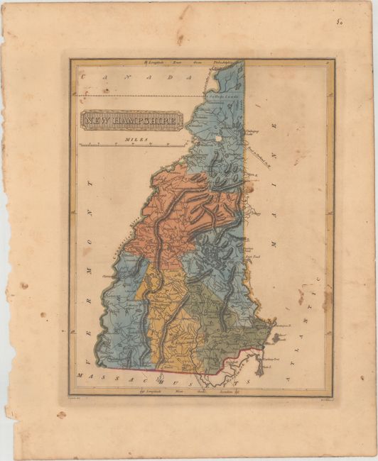
This uncommon and handsome map of New Hampshire includes roads, towns and cities, and topographical detail. County configuration is current with six counties delineated: Coos, Grafton, Stafford, Cheshire, Hillsborough, and Rockingham. Dartmouth is named, The Fifteen Miles Falls are identified on the Connecticut River, College Lands are depicted in Coos County, and roads to Portland and Quebec are outlined. Drawn by Samuel Lewis and engraved by H.S. Tanner. Lucas' General Atlas is known as one of the finest general atlases produced in the U.S. at the time, due to the high quality paper, superior engraving quality, and attractive coloring style.
References: Phillips (Atlases) #3542-34.
Condition: B
In full original color with some light stains, light toning, minor foxing, and a small abrasion in Coos County.