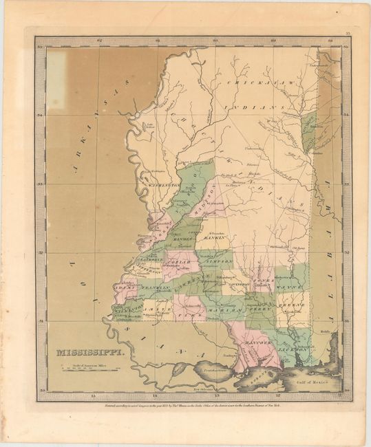
Subject: Mississippi
Period: 1835 (published)
Publication: A New Universal Atlas...
Color: Hand Color
Size:
10.7 x 12.3 inches
27.2 x 31.2 cm
A handsome, early map of Mississippi that details the county seats, roads, towns and settlements, and watersheds. Development is primarily in the southern and western portion of the state, and mostly along the rivers. The northern half of the state is in the possession of the Choctaw and Chickasaw Indian tribes, with Monroe County being the exception where Cotton Gin Port is located. The early U.S. government built a cotton gin here in 1801 as part of a "plan of civilization" for the Chickasaw Indians.
David Burr was appointed to be topographer to the U.S. Post Office Department in 1832 and was unable to complete the maps for A New Universal Atlas. Thomas Illman assumed responsibility for completing the atlas, publishing it in 1835 using the New York firm of D.S. Stone. The imprint of Thomas Illman is below the neatline.
References:
Condition: B
Original color with some light oxidation of the pigment surrounding the state along with some minor foxing.