Catalog Archive
Auction 163, Lot 313

"Map of the Northern Part of the State of Maine and of the Adjacent British Provinces, Shewing the Portion of That State to Which Great Britain Lays Claim...", Dashiell, S. L.
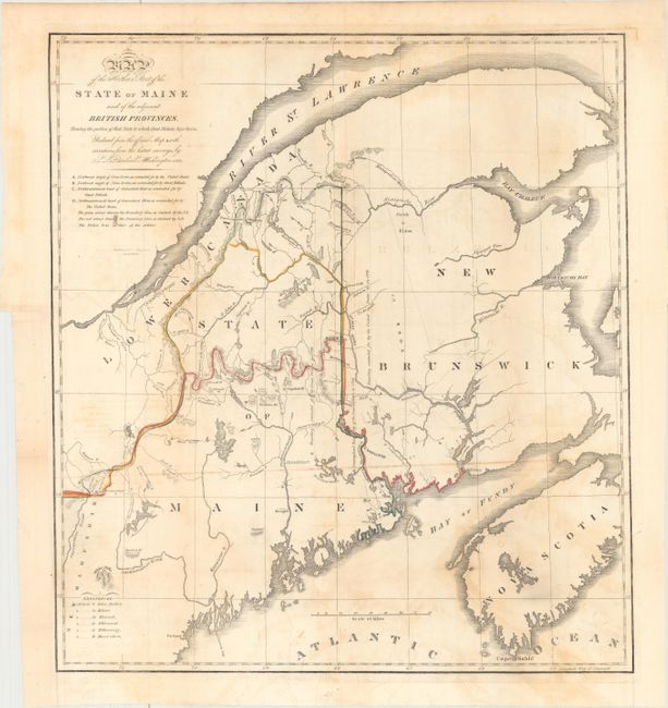
Subject: Maine

Period: 1830 (circa)

Publication:

Color: Hand Color

Size:
15.7 x 17.3 inches
39.9 x 43.9 cm
Download High Resolution Image
(or just click on image to launch the Zoom viewer)

This map details the boundary dispute between the United States and Great Britain relating to Maine. Hand coloring is used to show the boundary as claimed by the United States and by Great Britain, with a third line labeled "that of the Arbiter" which closely corresponds to Maine's present-day border with Canada. A table gives the major points of contention in this border dispute. Another table names land grants belonging to six land holders. This is the earliest of three examples of this map, printed by B. Chambers.

References: Phillips (Maps) p. 384; cf. Claussen & Friis #220.

Condition: B

Issued folding and now flattened and backed with tissue. There is light toning and offsetting, and a binding trim at lower left that has been replaced with old paper.

Estimate: $160 - $190

Sold for: $120

Closed on 6/14/2017

Archived