Subject: Louisiana
Period: 1866 (dated)
Publication: Maps Accompanying the Report of the Commissioner of the General Land Office...
Color: Hand Color
Size:
16 x 15.4 inches
40.6 x 39.1 cm
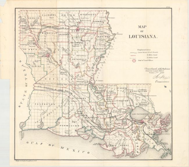
Published in the aftermath of the Civil War, this General Land Office map of Louisiana points to newly available public lands. It identifies land offices in Monroe, Natchitoches, and New Orleans and right-of-way limits, measured in units of six and fifteen miles. Two land grant railroads are traced: the New Orleans, Opelousas, and Great Western, and the Vicksburg and Shreveport. Drawn by Joseph Gorlinski and signed in the plate by the GLO Commissioner Jos. S. Wilson.
References: Lemmon, Magill & Wiese #89; Phillips (A) #1388-11.
Condition: B+
Issued folding with minor toning that is mostly concentrated to the left, a couple of small holes at fold intersections, and a few short fold separations that have been closed on verso with archival tape. There is a binding trim in the left blank margin, well away from image.