Subject: Florida
Period: 1823 (circa)
Publication: A General Atlas Containing Distinct Maps of All the Known Countries in the World...
Color: Hand Color
Size:
9.6 x 11.7 inches
24.4 x 29.7 cm
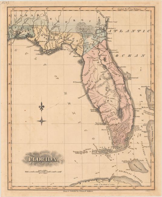
This attractive map was issued around the time that the Florida Territory was officially established as a possession of the United States. Most of the settlements, including St. Augustine, are located in the northern part of the territory, while the southern portion of the peninsula, under Seminole control, is bereft of European presence. It depicts only four counties: Escambia, Jackson, Duval, and a massive St. Johns. Only a few wagon roads are shown in the north, while a long "Indian path across the Country" is shown crossing from just east of Tampa Bay to the Atlantic Ocean. The map identifies "Cape Florida Settlement" near present-day Miami and locates an "Inundated Region called the Everglades." Lucas' General Atlas is known as one of the finest general atlases produced in the U.S. at the time, due to the high quality paper, superior engraving quality, and attractive coloring style. Engraved by B. Welch.
References: Phillips (Atlases) #742-76.
Condition: B+
Light scattered foxing.


