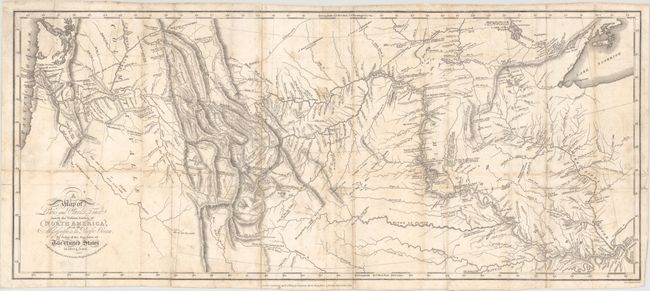
Subject: Western United States
Period: 1817 (published)
Publication:
Color: Black & White
Size:
27.5 x 11.8 inches
69.9 x 30 cm
This is the third London edition of this landmark map. Printed in 1817, it follows the 1814 Philadelphia edition, and the 1814 and 1815 London editions. The London editions contain a re-engraved map by Neele of nearly identical size, omitting the "Saml. Harrison sc." and showing the publisher's name below the bottom border.
The map is widely considered to be one of the most important maps in United States history. According to Wheat, "This 1814 map was the progenitor of many later maps, and one of the most influential ever drawn, its imprint still to be seen on maps of Western America." He continues, "This was a great map, a milestone of mapping in its time, and countless place names it gave to the face of America remain today as an ineradicable cultural heritage."
The map itself marks the culmination of a 28-month journey in which Meriwether Lewis and William Clark would finally dispel the notion of a Northwest Passage. Before their discoveries, it was widely believed that the headwaters of the Missouri River and Columbia River were very close to one another geographically, and that the only obstacle to creating a canal or portage was a plateau or gentle hill. Instead, Lewis and Clark discovered a series of rugged mountains dividing the two rivers. Additionally, they found that the waters off the western slopes of the Rockies were not navigable, compounding the problem. As a result of their expedition, the myth of the great Northwest Passage was finally put to rest, and the discoveries of Lewis and Clark would shape the next generation of cartographers and their maps of the western United States.
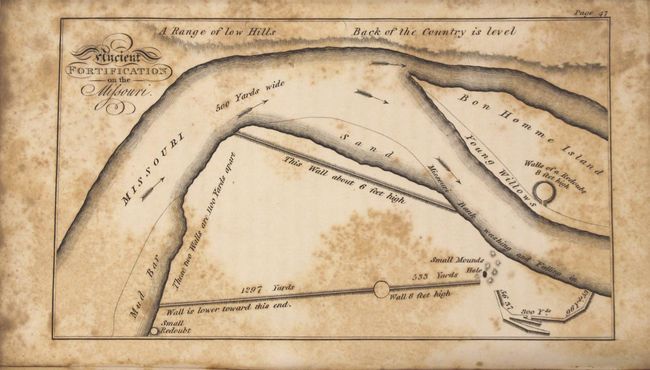
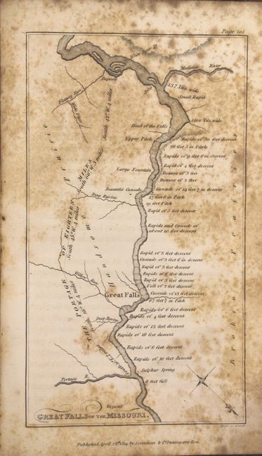
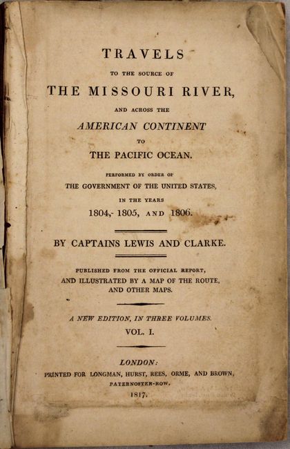
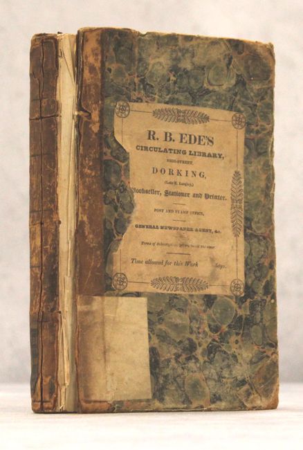
The map is accompanied by volume 1 (411 pages) of the three volume set and includes two additional plates: Ancient Fortification on the Missouri and Great Falls of the Missouri. Octavo, hardbound in quarter calf over marbled boards. Printed for Longman, Hurst, Rees, Orme, and Brown at Paternoster Row, London. Volume 1 only.
References: Howes #L317; Wagner-Camp 13:4; cf. Wheat (TMW) #317; cf. Streeter #3128; cf. Sabin #40830.
Condition: B
The folding map has been professionally backed with heavy tissue to rejoin the left third of the map which had separated along the fold line. A number of other fold separations and two small tears at left that extend 1" and 2" have also been professionally repaired with some minor loss at fold intersections. There is light surface soiling and minor foxing. Text is generally very good with light toning and only occasional foxing, while the two single-page maps are moderately foxed. The front cover has separated, the back cover has nearly separated, and the spine has essentially perished. A very worthy candidate for professional rebinding.