Subject: Mississippi River, Civil War
Period: 1891-95 (published)
Publication: Atlas to Accompany the Official Records of the Union and Confederate Armies...
Color: Printed Color
Size:
27.8 x 16.9 inches
70.6 x 42.9 cm
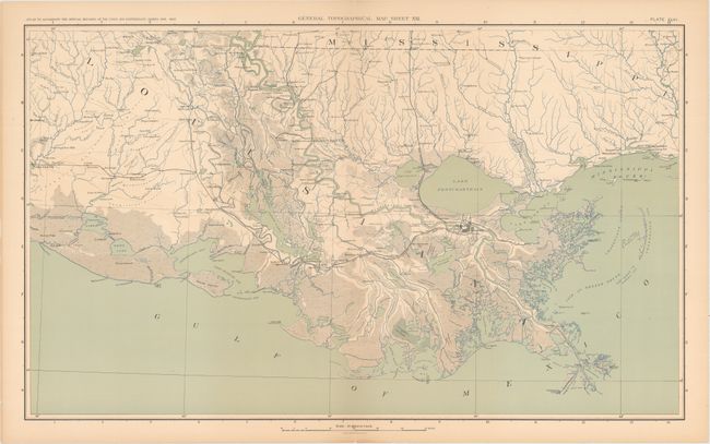
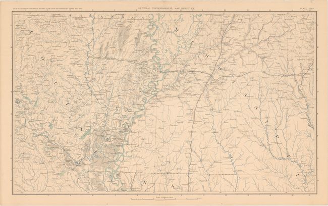
This lot of Civil War sheets comes from the government's comprehensive atlas covering the War Between the States. These plates were issued between 1891 and 1895 to accompany the Official Army Records and were published under the Secretaries of War Redfield Proctor, Stephen B. Elkins, and Daniel S. Lamont by Maj. Gen. George B. Davis, assisted by civilian experts Leslie Perry and Joseph Kirkley. These two maps focus on the Mississippi River from its mouth in the Gulf of Mexico to the southern border of Arkansas. There is excellent detail of the tributaries, cities, roads, railroads, and topography in the states of Louisiana and Mississippi.
References:
Condition: B+
Light toning. Sheet XX has a couple of small spots and extraneous creases near the right and left edges of the sheet. Sheet XXI has tiny centerfold separations at top and bottom and a couple of tiny tears along the edges of the sheet.