Subject: Alabama & Mississippi
Period: 1813 (published)
Publication: American Pocket Atlas
Color: Black & White
Size:
7.7 x 5.8 inches
19.6 x 14.7 cm
Mathew Carey was a seminal figure in early American publishing; establishing the first publishing firm to specialize in cartography and issuing the first atlas devoted exclusively to American maps. He set up an elaborate cottage system of craftsmen for compiling, engraving, printing, and coloring maps. This practice was emulated by later American cartographic publishers such as John Melish and Henry S. Tanner. The American Atlas concept was also adopted by other publishers in both the United States and Europe.
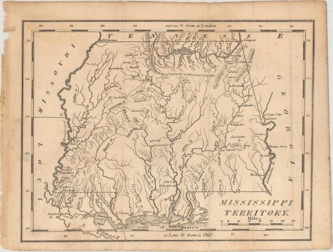
This uncommon early map of Mississippi Territory covers the region of present-day Mississippi and Alabama. This is the first separately published map of the Mississippi Territory to show the annexation of the Mobile District of West Florida, which occurred on May 14, 1812. This gave the entire southern portion of the US unfettered access to Gulf of Mexico shipping. At the extreme northwest corner of the map is Fort Pickering, near the future site of Memphis. Numerous Indian tribes and villages are located along with a few early settlements and forts. There is fine detail of the region's watershed. New Orleans, Mobile, and Pensacola are identified.
References: Phillips (Atlases) #1370-19a.
Condition: B+
A nice impression on a lightly toned sheet with faint dampstains along the top and bottom border.