Subject: Holy Land, Cyprus
Period: 1744 (dated)
Publication:
Color: Hand Color
Size:
21.6 x 18.2 inches
54.9 x 46.2 cm
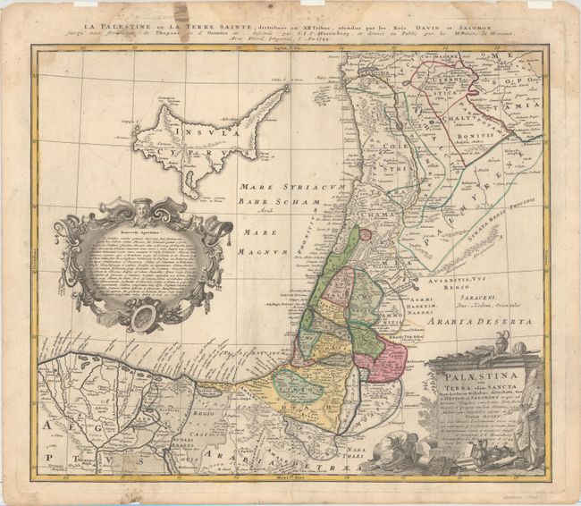
This map of the Holy Land extends to include the Nile River Delta and the island of Cyprus. Palestine is divided into the 12 Tribes. The map is attributed to Johann Christoph Harenberg. The map is adorned with two ornate cartouches. An alternate French title appears above the map: "La Palestine ou la Terre Sainte, Distribuee en XII Tribus, Etendue par les Rois David et Salomon Jusqu'aux Frontieres de Thapsac ou d'Orontes etc."
References: Laor #324.
Condition: B+
Original color on watermarked paper with light printer's ink residue and a centerfold separation that just enters map image at bottom. There are light damp stains and mildew stains at top and bottom, entering about 1" into map at bottom and top right. Remnants of hinge tape along top edge of sheet on recto.