Catalog Archive
Auction 162, Lot 454

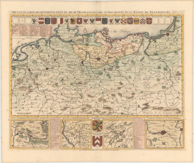
"Nouvelle Carte des Differents Etats du Roi de Prusse, et de Ceux des Autres Princes de la Maison de Brandebourg", Chatelain, Henry Abraham
Subject: Northern Europe

Period: 1708 (published)

Publication: Atlas Historique

Color: Hand Color

Size:
18.9 x 14.7 inches
48 x 37.3 cm
Download High Resolution Image
(or just click on image to launch the Zoom viewer)

This map focuses on Northern Germany and covers the area from the French border to Konigsburg (Kaliningrad), thus including part of today's Poland. The bottom is composed of four detail plans: the Frederick William Canal in Brandenburg, the principality of Orange, the principality of Neuchatel and Vallangin, and the vicinity of Berlin. City crests adorn the map.

References:

Condition: A

A crisp impression on paper with an "I C H" watermark, a couple of unobtrusive spots, and one small worm hole.

Estimate: $160 - $190

Unsold

Closed on 4/26/2017

Archived