Catalog Archive
Auction 162, Lot 385
"A New Map of the Island of Barbadoes, Containing All ye Parishes, and Principal Plantations...", Moll, Herman
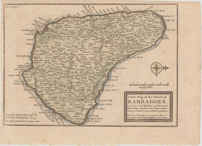
Subject: Barbados
Period: 1717 (circa)
Publication: Atlas Geographos...
Color: Hand Color
Size:
10.1 x 7.1 inches
25.7 x 18 cm
Download High Resolution Image
(or just click on image to launch the Zoom viewer)
(or just click on image to launch the Zoom viewer)