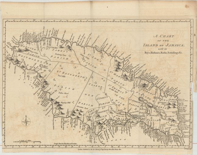
Subject: Jamaica
Period: 1780 (dated)
Publication: Political Magazine
Color: Black & White
Size:
15 x 10.2 inches
38.1 x 25.9 cm
This striking map of Jamaica is divided into the counties of Cornwall, Middlesex, and Surry and subdivided further into a number of parishes. The map is teeming with detail along the coasts, with a myriad of bays, rivers, harbors, cliffs, coves, and the like named. In the water, reefs, anchorages, and soundings are shown. There is considerably less detail inland, although many mountains are depicted, including the Blue Mountains. A compass rose capped with a fleur-de-lis appears at bottom left. Engraved by John Lodge.
References: Jolly #POL-10.
Condition: B
Issued folding with light offsetting. There is a binding trim at lower right and two small associated binding tears that just pass the neatline.