Subject: Bahamas & Greater Antilles
Period: 1856 (dated)
Publication:
Color: Black & White
Size:
23.2 x 36.5 inches
58.9 x 92.7 cm
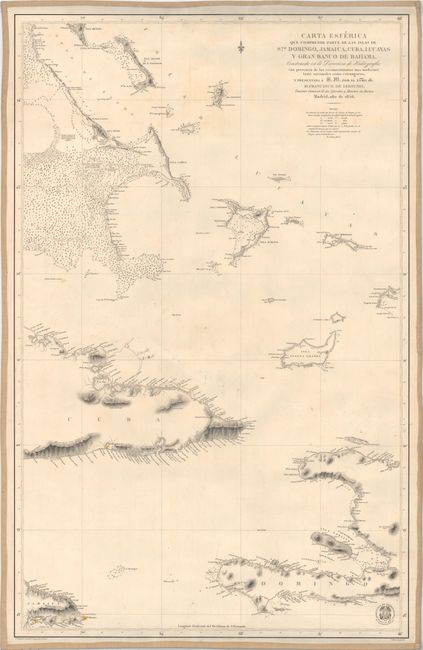
This strikingly engraved Spanish chart spans from the southern tip of Eleuthera, one of the many islands of the Bahamas, south to the eastern tip of Jamaica and the western coast of Haiti. Eastern Cuba is depicted as well. Even the smallest islands are shown with some topographical detail, and place names dot the coasts of the larger islands. There is dense nautical information, including soundings, bottom types, and notes around Exuma to help navigate the cays. A key to identify bottom types appears below the title. Drafted and with lettering by F. Bregante. Engraved by P. Serra. The engraved seal of the Direccion de Hidrografia appears at bottom right with the price Precio 20 Rs.Vn. Spanish sea charts are rare on the market.
References:
Condition: B+
A sharp impression backed in linen with light soiling and scattered foxing and some minor extraneous creases.