Subject: Mexico
Period: 1622 (circa)
Publication: Description des Indes Occidentales
Color: Hand Color
Size:
11.5 x 8.4 inches
29.2 x 21.3 cm
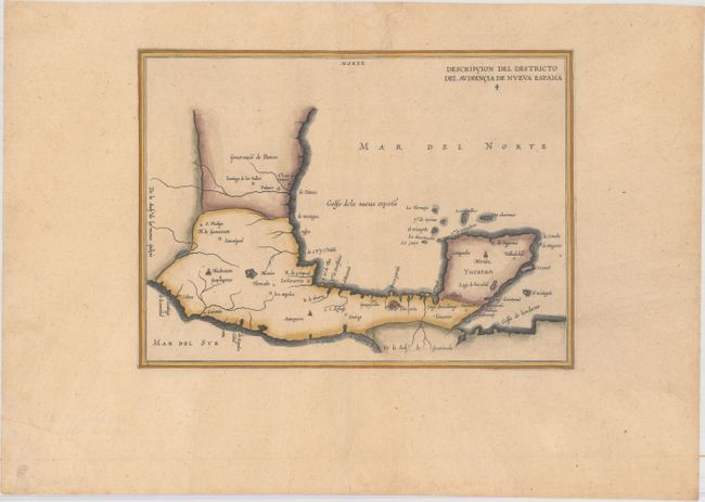
Antonio de Herrera Y Tordesillas was the official historian of Spain and the Indies. He compiled a history of the Spanish conquests and early explorations in the Americas, which included this simply engraved map of the Caribbean. His work (Historia general de los hechos de los Castellanos) was originally published in 1601 with several editions and translations thereafter, all of which are scarce. This simple outline map, based on Juan Lopez de Velasco’s manuscript, covers the southern part of present-day Mexico and the Yucatan peninsular. Mexico City is shown located on a large lake. Some of the early Spanish settlements in that region are marked including the important Pacific settlement at Puerto de Acapulco.
References: Shirley (BL Atlases) G.HERR-2a #4.
Condition: B+
A nice impression with wide margins, light toning, and some extraneous creasing along the centerfold. A small chip along the top edge of the sheet has been professionally repaired.