Subject: Mississippi
Period: 1829 (circa)
Publication: A New General Atlas...
Color: Hand Color
Size:
8.6 x 11.3 inches
21.8 x 28.7 cm
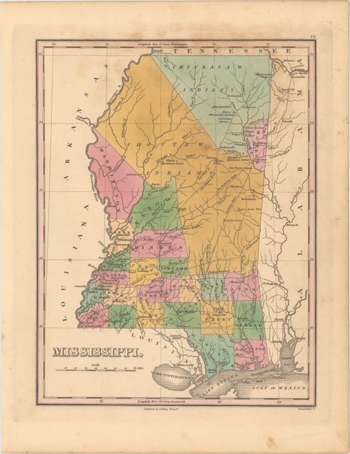
Finely's maps employ a delicate and elegant engraving style and provided extensive topographical and watershed information. He was the dominant map maker in the United States in the early 1820s into the 1830s. His atlases were very successful, outselling rival atlases by Carey & Lea, and Tanner. His maps were printed on high quality paper and were routinely corrected and updated.
A handsome map of Mississippi that details the county seats, roads, towns and settlements, and watersheds. Development is primarily in the southern and western portion of the state, and mostly along the rivers. The northern half of the state is in the possession of the Choctaw and Chickasaw Indian tribes, with Monroe County being the exception where Cotton Gin Port is located. The early U.S. government built a cotton gin here in 1801 as part of a "plan of civilization" for the Chickasaw Indians. Three missionary stations are located; Monroe in Chickasaw territory, and Elliot and Mayhew in Choctaw territory. The Old Natchez Road, Robinson Road and Jackson's Road are located, along with several new roads in the south. Engraved by Young & Delleker.
References:
Condition: B+
Original color with light scattered foxing at top.