Subject: Maryland
Period: 1904-53 (dated)
Publication:
Color: Printed Color
This attractive group of 9 maps were produced by the Maryland Geological Survey and the U.S. Geological Survey. They cover a period of nearly 50 years and show the geology of the state through bold coloring and texture. Several of the maps include depictions of Baltimore and the District of Columbia. The full list of maps includes:
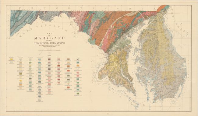
A. Map of Maryland Showing Geological Formations, dated 1933 (41.4 x 34.6"). Condition: Pleasant light toning. (A)
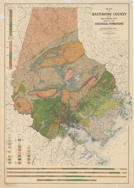
B. Map of Baltimore County and Baltimore City Showing the Geological Formations, dated 1925 (33.5 x 48.1"). Condition: There are two edge tears at top that enter 1" and 2" respectively into the image, along with numerous other edge tears and chips confined to the blank margins. (B+)
C. Geologic Map of Montgomery County and the District of Columbia, dated 1953 (36.8 x 48.9"). Condition: There is some crumpling of the paper confined to the blank margins, but near fine in the image. (A)
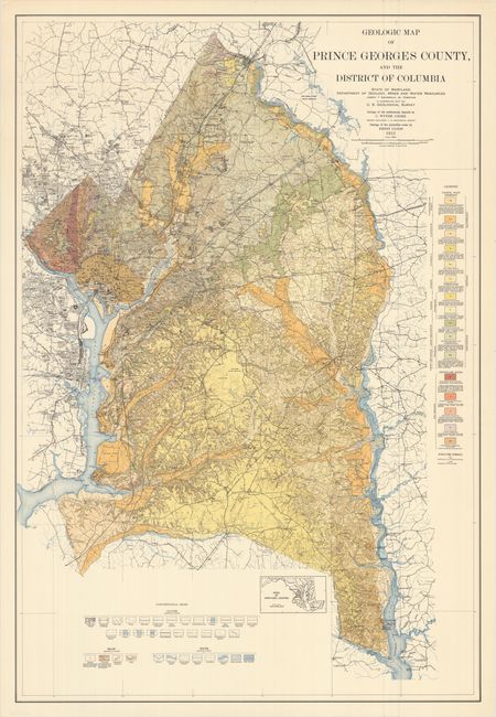
D. Geologic Map of Prince Georges County, and the District of Columbia, dated 1951 (30.9 x 45.3"). Condition: Near fine. (A)
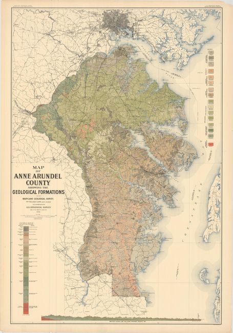
E. Map of Anne Arundel County Showing the Geological Formations, dated 1916 (31.1 x 46.3"). Condition: There are several minor edge tears confined to the blank margins, a few of which have been closed on verso with tape. (A)
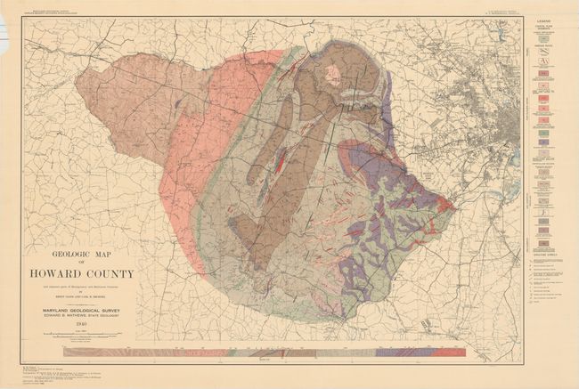
F. Geologic Map of Howard County and Adjacent Parts of Montgomery and Baltimore Counties, dated 1940 (35.0 x 24.4"). Condition: Pleasant light toning. (A)
G. Map of Harford County Showing the Geological Formations, dated 1904 (32.9 x 35.1"). Condition: There are several edge tears that enter the image including a 5" tear at bottom, a 2" tear at bottom, and a 1" tear at top. There is also a 2" tear in the image at lower left. (C+)
H. Map of Queen Anne's County Showing the Geological Formations, dated 1915 (42.8 x 32.9"). Condition: There are two edge tears at top left that enter 1.5" and 2" respectively into the image along with several other edge tears confined to the top and right blank margin. (B)
I. Map of Kent County Showing the Geological Formations, dated 1915 (34.1 x 32.5"). Condition: There are two short edge tears that enter the image at bottom and a few confined to the blank margins. (B+)
References:
Condition:
See description above.