Subject: St. Andrew's Bay, Florida
Period: 1855 (dated)
Publication:
Color: Black & White
Size:
19.3 x 17.6 inches
49 x 44.7 cm
The Office of Coast Survey is the oldest U.S. scientific organization, dating from 1807 when Congress directed that a "survey of the coast" be carried out. By 1836, it was called the U.S. Coast Survey and in 1878, the name was changed to the U.S. Coast and Geodetic Survey. Today the Office of Coast Survey is a division of the National Oceanic and Atmospheric Administration NOAA.
The survey teams, composed of civilians as well as Army and Naval officers, charted the nation's waterways and produced a wide array of reports, survey charts, hydrographic studies of tides and currents, astronomical studies and observations, and coastal pilots. These charts are an important record of the changing nature of the nation's coastlines. In additional to coastal charts, the U.S. Coast and Geodetic Survey produced land sketches, Civil War battle maps, and the early aeronautical charts.
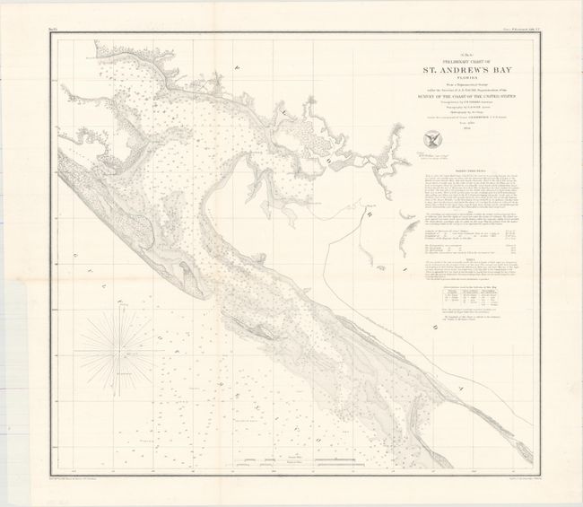
This striking chart from the U.S. Coast Survey depicts St. Andrew's Bay along the western edge of Florida in intricate detail. It includes soundings, sailing directions, bottom types, and other navigational information. Lithography by Bowne and Hasbrouck.
References:
Condition: B+
A nice impression issued folding, now flat and backed with tissue to repair several fold separations and a small hole at a fold intersection. There is minor toning along some of the folds and a binding trim confined to the left blank margin.