Subject: Southwestern United States
Period: 1936-40 (dated)
Publication:
Color: Printed Color
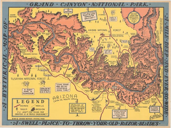
A. A Hysterical Map of Grand Canyon National Park - A Mile Deep and Ever So Wide - A Swell Place to Throw Your Old Razor Blades, by the Lindgren Brothers, dated 1940 (23.5 x 17.6"). This graphic map of Grand Canyon National Park was "Drawn in Broken English" by Jolly Lindgren, who published a number of humorous maps of national parks including Yellowstone and Bryce Canyon. It depicts the park in a light-hearted manner, with a number of silly one-liners including "Don't Crowd Folks Plenty of Seats in the Balcony", "Come Down and See My Etchings Some Time", and "Speaking of Depressions, This One Has Been Here Quite a While Too!" Cartographically, the map shows the roads, trails, and various points of interest within in the park with a compass rose stating that "This Part, Ladies and Gentlemen, Is Correct!" This is the larger version of the map with the banner at bottom "A Swell Place to Throw Your Old Razor Blades." Reference: Rumsey #6127. Condition: A fine example. (A+)
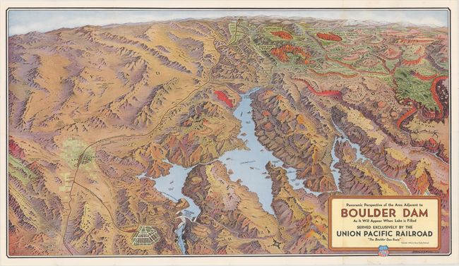
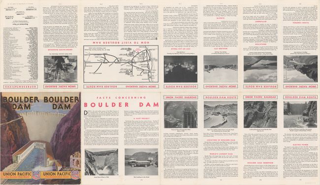
B. Panoramic Perspective of the Area Adjacent to Boulder Dam as It Will Appear When Lake Is Filled..., by Union Pacific Railroad, dated 1936 (30.2 x 17.0"). This is a great example of pictorial bird's-eye-style maps that were used for advertising and publicity in the early part of the 20th century. This colorful perspective map covers the region serviced by the Union Pacific Railroad, from Salt Lake City (shown on the distant horizon) down to Boulder City, which appears to be larger than Las Vegas. It has a great depiction of Boulder Dam including a small portion of Black Canyon and shows water spraying from the turbine generator outlets. Steamships (!) are shown in Lake Mead. The map also includes the Grand Canyon, the National Parks of Bryce and Zion, Cedar Breaks Nat. Monument, and more. The route of Union Pacific Tours is shown along the north rim of the Grand Canyon where the Union Pacific Grand Canyon Lodge is prominently located. This striking image was drawn by Gerald A. Eddy of Los Angeles. The verso is filled with information for the tourist including photographs taken during the dam's construction, a road map of the west and an early photograph of Las Vegas. Self folds into covers showing Boulder Dam drawn and titled in Art Deco style. Condition: Clean and bright with bold color. There is one tiny tear confined to the bottom blank margin. (A)
References:
Condition:
See description above.